File:AddTrafficAsPoints.png
From CUOSGwiki
Jump to navigationJump to search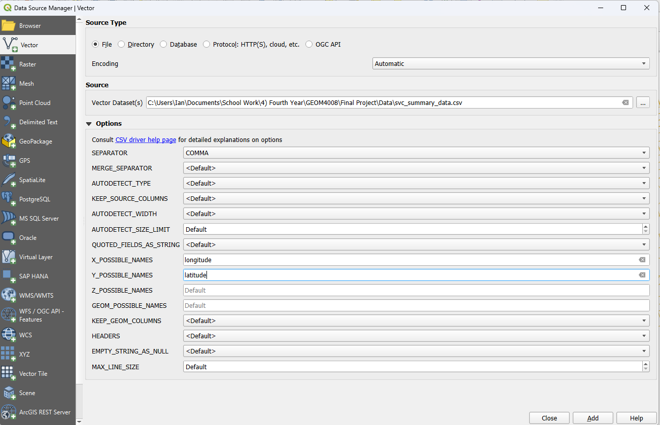
Size of this preview: 800 × 515 pixels. Other resolutions: 320 × 206 pixels | 1,301 × 838 pixels.
Original file (1,301 × 838 pixels, file size: 114 KB, MIME type: image/png)
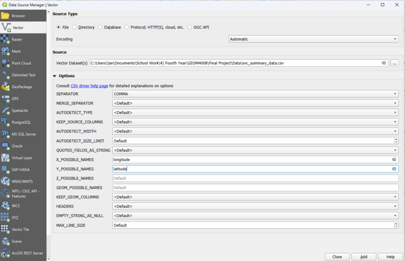
SS of QGIS. Adding csv data as a point layer.
File history
Click on a date/time to view the file as it appeared at that time.
| Date/Time | Thumbnail | Dimensions | User | Comment | |
|---|---|---|---|---|---|
| current | 20:27, 18 November 2025 | | 1,301 × 838 (114 KB) | IanShintani (talk | contribs) |
You cannot overwrite this file.
File usage
The following page uses this file: