File:Comparison of Hillshade Rendering Using Different Illumination Parameters.png
From CUOSGwiki
Jump to navigationJump to search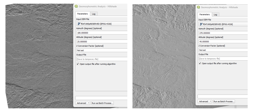
Size of this preview: 800 × 347 pixels. Other resolutions: 320 × 139 pixels | 849 × 368 pixels.
Original file (849 × 368 pixels, file size: 291 KB, MIME type: image/png)
This figure illustrates the effect of varying hillshade parameters on terrain visualization. The left image is generated using an azimuth of 180° and a lower illumination altitude, which enhances valley networks and linear depressions. The right image uses an azimuth of 270° with a higher illumination altitude, emphasizing convex landforms, ridges, and subtle slope transitions. Adjusting hillshade parameters allows users to reveal different geomorphic features and better interpret terrain structure.
File history
Click on a date/time to view the file as it appeared at that time.
| Date/Time | Thumbnail | Dimensions | User | Comment | |
|---|---|---|---|---|---|
| current | 12:27, 16 December 2025 | | 849 × 368 (291 KB) | Catherine (talk | contribs) |
You cannot overwrite this file.
File usage
There are no pages that use this file.