File:Contours.png
From CUOSGwiki
Jump to navigationJump to search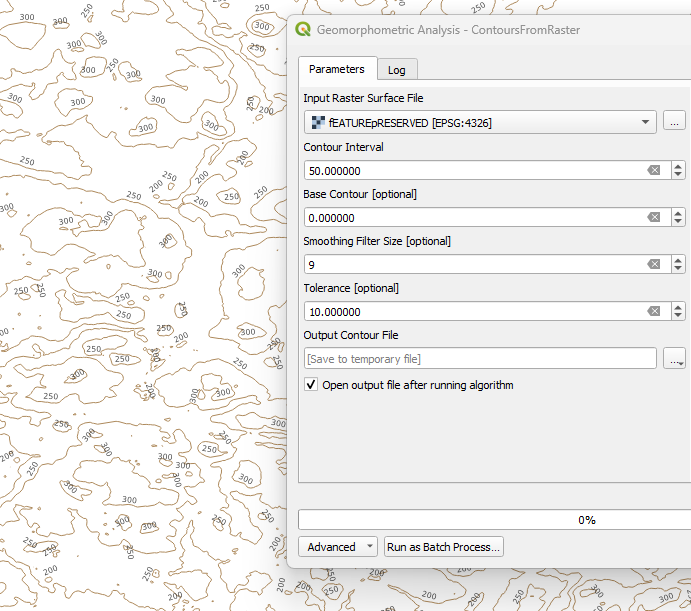
Size of this preview: 678 × 600 pixels. Other resolutions: 271 × 240 pixels | 691 × 611 pixels.
Original file (691 × 611 pixels, file size: 180 KB, MIME type: image/png)
This figure shows contour lines generated from the feature-preserved DEM using a 50-meter contour interval. Areas where contours are tightly spaced correspond to steeper slopes, while wider spacing indicates gentler terrain, providing a clear and intuitive representation of landscape morphology.
File history
Click on a date/time to view the file as it appeared at that time.
| Date/Time | Thumbnail | Dimensions | User | Comment | |
|---|---|---|---|---|---|
| current | 12:18, 17 December 2025 | | 691 × 611 (180 KB) | Catherine (talk | contribs) |
You cannot overwrite this file.
File usage
There are no pages that use this file.