File:FRA NDVI Map.PNG
From CUOSGwiki
Jump to navigationJump to search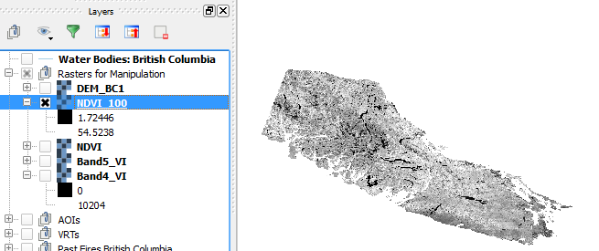
No higher resolution available.
FRA_NDVI_Map.PNG (655 × 275 pixels, file size: 57 KB, MIME type: image/png)
The output of the NDVI * 100 calculation with values that will be reclassified and the visualization of what the NDVI looks like.
File history
Click on a date/time to view the file as it appeared at that time.
| Date/Time | Thumbnail | Dimensions | User | Comment | |
|---|---|---|---|---|---|
| current | 18:54, 15 December 2015 | | 655 × 275 (57 KB) | Adgey93 (talk | contribs) | The output of the NDVI * 100 calculation with values that will be reclassified and the visualization of what the NDVI looks like. |
You cannot overwrite this file.
File usage
There are no pages that use this file.