File:Figure17 MM.png
From CUOSGwiki
Jump to navigationJump to search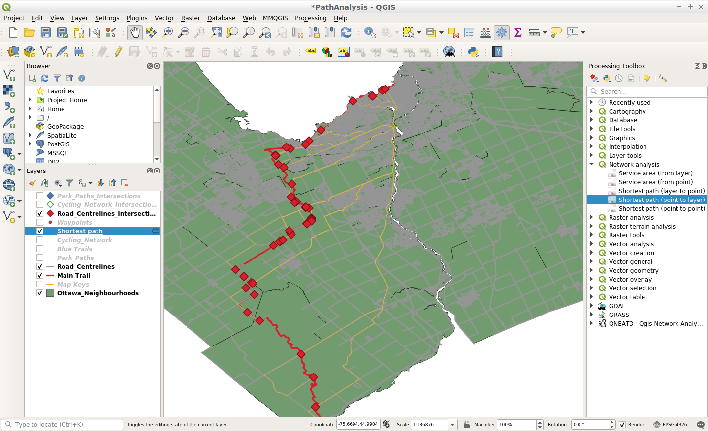
Size of this preview: 800 × 488 pixels. Other resolutions: 320 × 195 pixels | 1,438 × 877 pixels.
Original file (1,438 × 877 pixels, file size: 550 KB, MIME type: image/png)
A screenshot of the layer created by the Shortest path (point to layer) tool. This layer displays all of the shortest pathways from the chosen start point at Carleton University to each location where the Road_Centrelines layer intersects the Main Trail (Rideau Trail).
File history
Click on a date/time to view the file as it appeared at that time.
| Date/Time | Thumbnail | Dimensions | User | Comment | |
|---|---|---|---|---|---|
| current | 12:20, 6 October 2020 | | 1,438 × 877 (550 KB) | Misztal (talk | contribs) |
You cannot overwrite this file.
File usage
The following page uses this file: