File:Finallayout.jpg
From CUOSGwiki
Jump to navigationJump to search
Size of this preview: 800 × 569 pixels. Other resolutions: 320 × 228 pixels | 1,195 × 850 pixels.
Original file (1,195 × 850 pixels, file size: 302 KB, MIME type: image/jpeg)
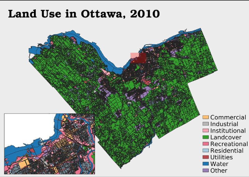
A map showing the land use in ottawa from 2010
File history
Click on a date/time to view the file as it appeared at that time.
| Date/Time | Thumbnail | Dimensions | User | Comment | |
|---|---|---|---|---|---|
| current | 11:38, 4 October 2020 | | 1,195 × 850 (302 KB) | Erci (talk | contribs) |
You cannot overwrite this file.
File usage
The following page uses this file: