File:Flood2m.png
From CUOSGwiki
Jump to navigationJump to search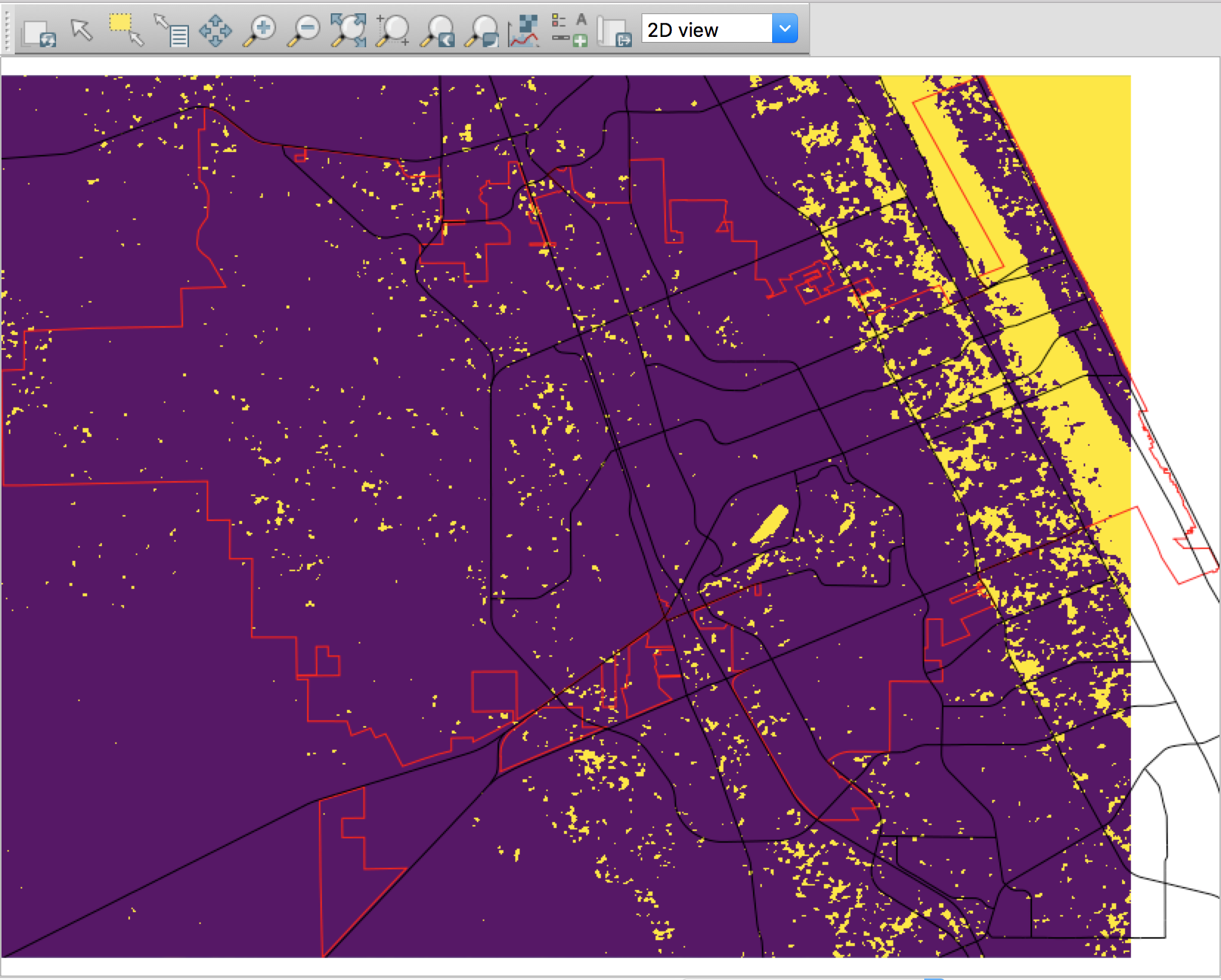
Size of this preview: 747 × 600 pixels. Other resolutions: 299 × 240 pixels | 1,654 × 1,328 pixels.
Original file (1,654 × 1,328 pixels, file size: 775 KB, MIME type: image/png)
A flood risk map of Daytona Beach showing a rise of 2m in sea level (flooded areas are in yellow).
File history
Click on a date/time to view the file as it appeared at that time.
| Date/Time | Thumbnail | Dimensions | User | Comment | |
|---|---|---|---|---|---|
| current | 18:54, 21 December 2018 | | 1,654 × 1,328 (775 KB) | Rjmitchell (talk | contribs) | A flood risk map of Daytona Beach showing a rise of 2m in sea level (flooded areas are in yellow). |
You cannot overwrite this file.
File usage
The following page uses this file: