File:GRASS map calculator loc.png
From CUOSGwiki
Jump to navigationJump to search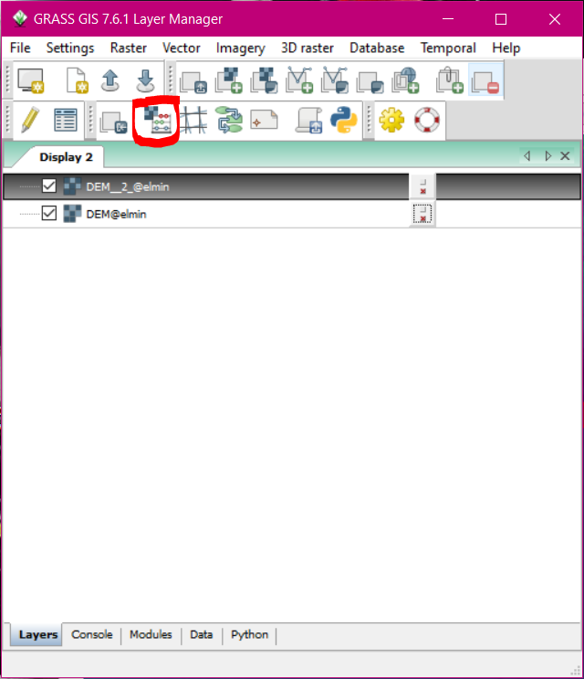
Size of this preview: 516 × 599 pixels. Other resolutions: 207 × 240 pixels | 640 × 743 pixels.
Original file (640 × 743 pixels, file size: 74 KB, MIME type: image/png)
location of the map calculator
File history
Click on a date/time to view the file as it appeared at that time.
| Date/Time | Thumbnail | Dimensions | User | Comment | |
|---|---|---|---|---|---|
| current | 21:21, 20 December 2020 | | 640 × 743 (74 KB) | Opowell (talk | contribs) |
You cannot overwrite this file.
File usage
The following page uses this file: