File:GeomorphonsFigure.png
From CUOSGwiki
Jump to navigationJump to search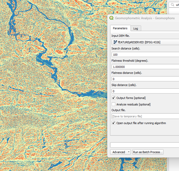
Size of this preview: 628 × 600 pixels. Other resolutions: 251 × 240 pixels | 691 × 660 pixels.
Original file (691 × 660 pixels, file size: 351 KB, MIME type: image/png)
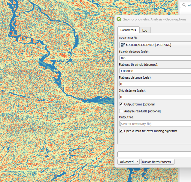
This figure shows the geomorphons landform classification derived from the feature-preserved DEM using the WhiteboxTools Geomorphons algorithm. The resulting map distinguishes characteristic landform elements such as valleys, slopes, ridges, shoulders, and flat areas, providing an objective, scale-dependent representation of landscape morphology.
File history
Click on a date/time to view the file as it appeared at that time.
| Date/Time | Thumbnail | Dimensions | User | Comment | |
|---|---|---|---|---|---|
| current | 12:58, 16 December 2025 | | 691 × 660 (351 KB) | Catherine (talk | contribs) |
You cannot overwrite this file.
File usage
The following page uses this file: