File:GeoreferencingRasterImageryinQGISusingVectorData(figure2 edit dylan).png
From CUOSGwiki
Jump to navigationJump to search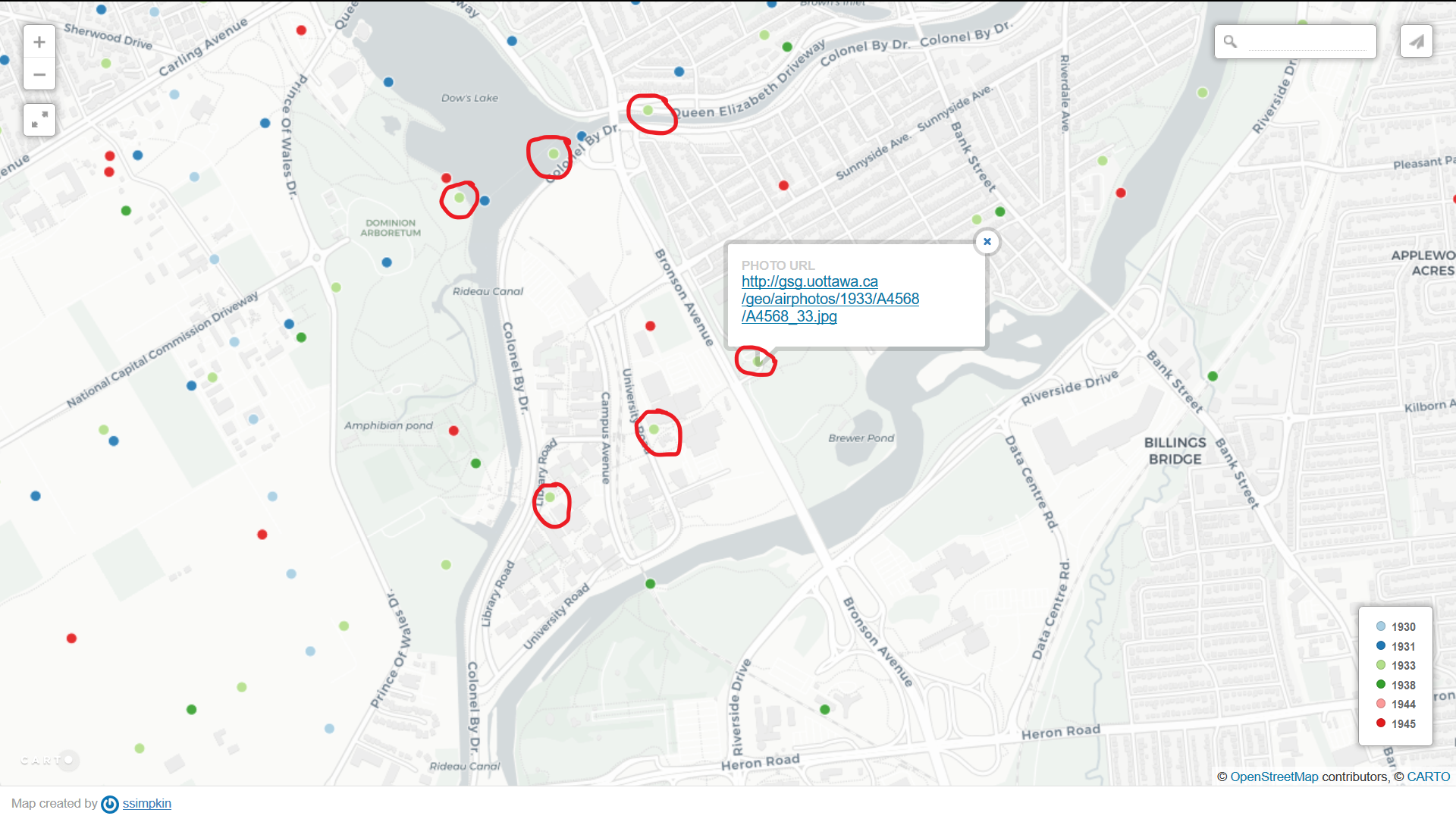
Size of this preview: 800 × 450 pixels. Other resolutions: 320 × 180 pixels | 1,920 × 1,080 pixels.
Original file (1,920 × 1,080 pixels, file size: 1.33 MB, MIME type: image/png)
Summary
Edited by Dylan Jones: Figure 2 from Georeferencing Raster Imagery in QGIS Using Vector Data
File history
Click on a date/time to view the file as it appeared at that time.
| Date/Time | Thumbnail | Dimensions | User | Comment | |
|---|---|---|---|---|---|
| current | 14:26, 7 October 2022 | | 1,920 × 1,080 (1.33 MB) | Dylanjones (talk | contribs) | Edited by Dylan Jones: Figure 2 from Georeferencing Raster Imagery in QGIS Using Vector Data |
You cannot overwrite this file.
File usage
The following page uses this file:
.png&oldid=18753)
.png)
.png&action=edit&redlink=1)
.png&action=edit)
.png&action=history)
.png)
.png)
.png&printable=yes)
.png&oldid=18753)
.png&action=info)