File:HypsometricallTinted.png
From CUOSGwiki
Jump to navigationJump to search
Size of this preview: 550 × 599 pixels. Other resolutions: 220 × 240 pixels | 573 × 624 pixels.
Original file (573 × 624 pixels, file size: 530 KB, MIME type: image/png)
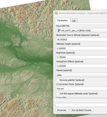
This figure shows a hypsometrically tinted hillshade generated using WhiteboxTools, combining elevation-based color shading with multi-directional hillshading. The result enhances both elevation variation and terrain texture, allowing clearer visualization of landforms such as ridges, valleys, and slope transitions.
File history
Click on a date/time to view the file as it appeared at that time.
| Date/Time | Thumbnail | Dimensions | User | Comment | |
|---|---|---|---|---|---|
| current | 12:18, 16 December 2025 | | 573 × 624 (530 KB) | Catherine (talk | contribs) |
You cannot overwrite this file.
File usage
The following page uses this file: