File:TopographiIndex.png
From CUOSGwiki
Jump to navigationJump to search
Size of this preview: 555 × 599 pixels. Other resolutions: 222 × 240 pixels | 589 × 636 pixels.
Original file (589 × 636 pixels, file size: 457 KB, MIME type: image/png)
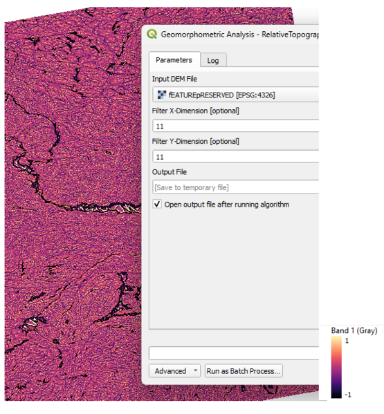
This figure shows the Relative Topographic Position Index (RTPI) computed from the feature-preserved DEM using a moving window of 11 × 11 cells. Positive values represent locally elevated areas such as ridges and upper slopes, while negative values indicate depressions and valley floors.
File history
Click on a date/time to view the file as it appeared at that time.
| Date/Time | Thumbnail | Dimensions | User | Comment | |
|---|---|---|---|---|---|
| current | 12:51, 16 December 2025 | | 589 × 636 (457 KB) | Catherine (talk | contribs) |
You cannot overwrite this file.
File usage
The following page uses this file: