File:Topographic Wetness Index Raster.png
From CUOSGwiki
Jump to navigationJump to search
Size of this preview: 729 × 599 pixels. Other resolutions: 292 × 240 pixels | 1,029 × 846 pixels.
Original file (1,029 × 846 pixels, file size: 1.29 MB, MIME type: image/png)
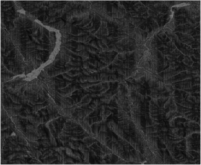
The Topographic Wetness Index raster generated using WhiteboxTools' WetnessIndex tool in QGIS.
File history
Click on a date/time to view the file as it appeared at that time.
| Date/Time | Thumbnail | Dimensions | User | Comment | |
|---|---|---|---|---|---|
| current | 16:47, 8 December 2025 | | 1,029 × 846 (1.29 MB) | BrownWidow (talk | contribs) |
You cannot overwrite this file.
File usage
The following page uses this file: