Difference between revisions of "Highly Effective Construction of Thematic Maps"
From CUOSGwiki
Jump to navigationJump to search| Line 8: | Line 8: | ||
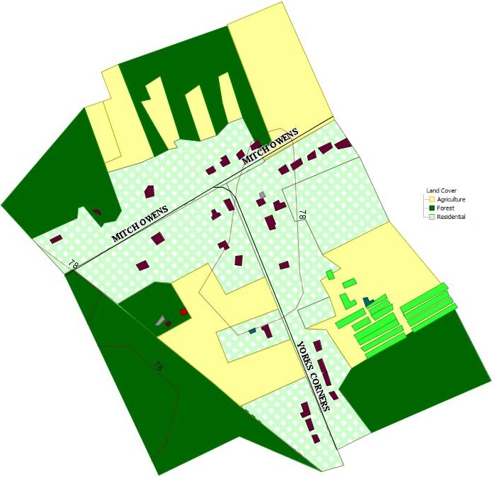
OpenJUMP is a Free and Open Source Software for Geospatial (FOSS4G) program that can be downloaded from http://openjump.org/. It is an excellent software package that is similar to other commonly using Geographic Information Systems (GIS) like ArcGis or Quantum GIS. The feature that really sets it apart from other programs is that the main focus of its tools and functionality leans more towards style. This tutorial will demonstrate the construction of a common thematic map like the one shown in Figure 1.1 below using OpenJump. |
OpenJUMP is a Free and Open Source Software for Geospatial (FOSS4G) program that can be downloaded from http://openjump.org/. It is an excellent software package that is similar to other commonly using Geographic Information Systems (GIS) like ArcGis or Quantum GIS. The feature that really sets it apart from other programs is that the main focus of its tools and functionality leans more towards style. This tutorial will demonstrate the construction of a common thematic map like the one shown in Figure 1.1 below using OpenJump. |
||
| − | <center>[[Image: |
+ | <center>[[Image:Figure2.10.jpg|700px|]]</center> |
Revision as of 04:34, 22 December 2013
OpenJUMP Tutorial by Thomas Brown
Introduction to OpenJUMP
OpenJUMP is a Free and Open Source Software for Geospatial (FOSS4G) program that can be downloaded from http://openjump.org/. It is an excellent software package that is similar to other commonly using Geographic Information Systems (GIS) like ArcGis or Quantum GIS. The feature that really sets it apart from other programs is that the main focus of its tools and functionality leans more towards style. This tutorial will demonstrate the construction of a common thematic map like the one shown in Figure 1.1 below using OpenJump.
