Difference between revisions of "Analyzing Crime Data in Ottawa using QGIS"
Selimerguden (talk | contribs) |
Selimerguden (talk | contribs) |
||
| Line 8: | Line 8: | ||
==Loading the Dataset into the QGIS== |
==Loading the Dataset into the QGIS== |
||
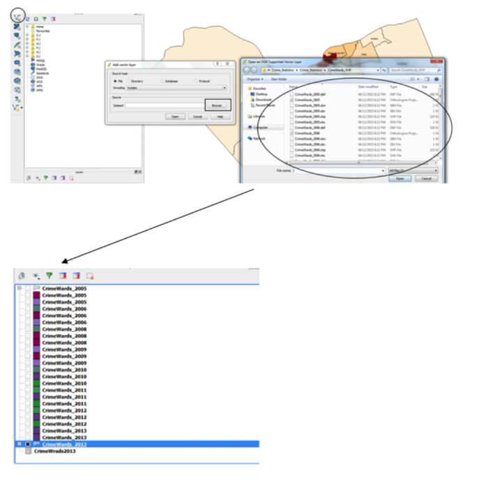
| − | + | First step was to select Add Vector Layer symbol. Second step was to use Browse function to locate the data. Finally all shp files were selected from the Crime Wards Shp folder and loaded to the QGIS. |
|
[[File:loading.png|700px]] |
[[File:loading.png|700px]] |
||
Revision as of 13:38, 16 December 2015
Introduction
The main purpose of this tutorial was to determine the criminal trends based on the spatial locations in Ottawa using open source software. The QGIS was selected for the purpose of this tutorial it can be downloaded from: (https://www.qgis.org/en/site/forusers/download.html). The data includes many different crimes occurred in Ottawa from 2005 to 2013. The spatial locations include: Orleans, Innes, Barrhaven, Kanata North, West-Carleton March, Stittsville-Kanata West, Bay, College, Knoxdale-Merivale, Gloucester-Southgate, Beacon Hill-Cyrville, Rideau Vanier, Rideau-Rockcliffe, Somerset, Kicthissippi, River, Capital, Alta Vista, Cumberland, Osgoode, Rideau-Golbourn, Gloucester-South Nepean and Kanata South. Some of the crimes include: Total Criminal Code of Canada (CCC) including Traffic, Total Criminal Code of Canada (CCC) excluding Traffic, Crimes against Person, Total number of Homicides, Total Number of Attempted Murders, Total Number of Robberies and Total Number of Assaults (including Sexual Assaults), Total Number of Other Sexual Offences, Number of Abductions, Total Number of Uttering Threats or Intimidation Offences, Total Number of Other Crimes.
Where to get the data?
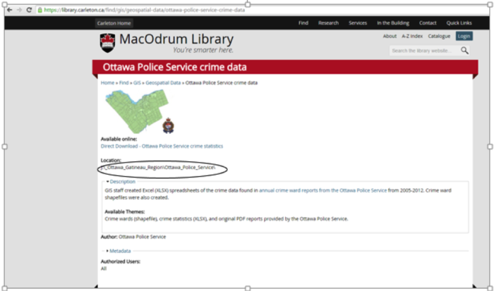
Based on the statistical data that the City of Ottawa Police Services provided, the Carleton University staff at the MADGIC desk created the shafiles and it was downloaded from the MacOdrum Library website. It is an open source data no login information is required.
Retrieved from: http://madgic.library.carleton.ca/deposit/GIS/Crime_Statistics.zip

Loading the Dataset into the QGIS
First step was to select Add Vector Layer symbol. Second step was to use Browse function to locate the data. Finally all shp files were selected from the Crime Wards Shp folder and loaded to the QGIS.
