Exploring Hydrological Analyses using ILWIS
Contents
- 1 Purpose
- 2 Introduction to ILWIS and the Project Tutorial
- 3 Methods
- 4 Conclusion
- 5 References
Purpose
This Wiki tutorial has been produced for the purpose of exploring and describing the methods used for hydrological analyses in ILWIS (a FOSS4G program). The objective of this tutorial is to provide users with a better understanding of how the hydrological analyses within ILWIS works, in addition to providing the instructions necessary to reach the desired output for their study region. Additionally, this tutorial will allow for comparison of ILWIS and SAGA GIS, using the same data for analysis as the Exploring Hydrological Analyses using SAGA GIS tutorial from 2013.
Introduction to ILWIS and the Project Tutorial
ILWIS stands for "Integrated Land and Water Information System". It is a open source Geographic Information System software program that was designed to be a user-friendly integrated software that contains both raster and vector processing capabilities, allowing for both analyses on remotely sensed images, vector maps and numerous spatial modeling abilities. ILWIS was developed by the International Institute for Aerospace Survey and Earth Sciences (ITC) in The Netherlands. This tutorial will focus on its ability to use Digital Elevation Models (DEMs)to run hydrological analyses of a study region. More information about this product can be found on the ILWIS Website
This project will focus on hydrological analysis of Okanagan Lake, a popular tourist destination in British Columbia, Canada. The tutorial will cover topics such as Aspect mapping, Slope mapping, Watershed Delineation mapping and Wetness Index mapping through the use of ILWIS hydrological analysis tools.
Methods
Data and Programs
In order to carry out this exercise, a DEM of the area of interest is needed. For this project a open source DEM was obtained using the Geospatial Data Extractiontool created by Natural Resources Canada.
For DEMs located outside of Canada open source DEMs can be obtained from ASTER and SRTM Global Digital Elevation Model - USGS
This turtorial explores the hydrological toolset for ILWIS, but the use of open-source program QGIS is needed as well. This can be downloaded fromthe QGIS website
Getting Started
Before starting any analysis, create your working folder and ensure all data needed for the exercise are in this folder. Keeping all your data in one folder will make analysis easier.
Starting ILWIS
ILWIS 3.08.03 can be downloaded for free from 52 North.The newer version of ILWIS 3.08.04 is available but do not download this one, as a bug does not allow you to import DEMs into this version.
- Ensure that ILWIS 3.08.03 is properly installed on your computer
- Locate ILWIS from the Program list and double click on the icon to launch program.
- ILWIS main page will open
- Use the ILWIS Navigator Tab to locate your working folder. The Navigator lists all drivers and directories.
INSERT main page picture here
Figure ??: Screenshot of ILWIS Interface
Importing DEMs
1) Click Operations --> Import/Export --> GDAL (Geospatial Data Abstraction Library)
printscreen
2) An Import window will open
3) Click to the DEM you want to import and ensure that the import format is Use GDAL.
5) Give your Output DEM a name and click OK
6) To view your DEM go to Operations -> Visualization -> Show map. A new window will open with the DEM.
Projecting a DEM in QGIS
Projecting in ILWIS did not work, so QGIS (another open source GIS software) was used instead. These steps explain how to load a DEM into QGIS, assign a projection, and export the DEM to be used in other software (e.g. ILWIS)
1) Download QGIS and open the program.
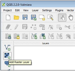
2) Add your DEM using the add raster layer tool (Figure ??). You will have to navigate to your working folder and select your DEM.

Fill Sinks in a DEM
Create Flow Direction Map
Create a Flow Accumulation Map
Drainage Network
Drainage Network Extraction
Drainage Network Ordering
Catchment Merging
Flow Length
Conclusion
This tutorial showed the steps required to run a hydrological analyses using a DEM in ILWIS software. GQIS was used to reproject the DEM, and ILWIS software was used to run the hydrological analysis on the landscape.
References
- 52 North
