Unused files
From CUOSGwiki
Jump to navigationJump to searchThe following files exist but are not embedded in any page. Please note that other web sites may link to a file with a direct URL, and so may still be listed here despite being in active use.
Showing below up to 50 results in range #1,101 to #1,150.
View (previous 50 | next 50) (20 | 50 | 100 | 250 | 500)
 NetworkAnalyst.png 219 × 503; 83 KB
 ModelUnrun.png 632 × 326; 51 KB
 ModelRun.png 628 × 324; 54 KB
 CarletonBusStops.PNG 621 × 810; 67 KB
 Model.pdf ; 44 KB
 ModelStage1.PNG 1,234 × 438; 34 KB
 CreateDataset.PNG 782 × 116; 14 KB
 MergeWalkways.PNG 570 × 201; 12 KB
 CUlogo.png 1,090 × 770; 79 KB
 Data Download Earth Quakes.jpg 1,875 × 932; 183 KB
 QGISRotate.png 457 × 316; 66 KB
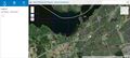 AIWebsite.JPG 1,912 × 863; 293 KB
 CRSMenu.jpg 860 × 862; 167 KB
 CRSMenu1.jpg 855 × 862; 167 KB
 SaveVectorLayerAsWindow.png 593 × 664; 41 KB
 Editing.png 540 × 381; 73 KB
 Projection2.0.png 506 × 680; 107 KB
 ProjectionNew.png 414 × 545; 79 KB
 QgisPlugins.png 628 × 393; 133 KB
 QGISPLUGINS2.png 632 × 390; 133 KB
 CatchmentArea.png 962 × 895; 37 KB
 CatchmentAreaBefore.png 1,165 × 856; 52 KB
 Snip 3, transformation.png 673 × 601; 47 KB
 Creating area per square km.png 681 × 655; 43 KB
 New creating a variable.png 684 × 660; 37 KB
 Screen Shot 2020-03-23 at 21.45.25.png 652 × 520; 55 KB
 Screen Shot 2020-10-04 at 21.48.21.png 1,440 × 900; 693 KB
 Capture.6.png 1,004 × 630; 58 KB
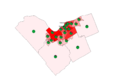 Adjusted pie chart.png 1,046 × 721; 76 KB
 HILLSHADE.tif 236 × 189; 46 KB
 Capture9.PNG 241 × 194; 55 KB
 Jc3b1.PNG 614 × 660; 120 KB
 Jc51.PNG 489 × 513; 15 KB
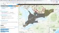 Area of Interest.jpg 1,920 × 1,080; 329 KB
 Creating Layers.png 1,262 × 484; 665 KB
 Digitizing on.png 637 × 131; 25 KB
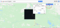 BandSettings.png 2,544 × 1,190; 650 KB
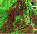 BeforeClassification.png 920 × 862; 1.69 MB
 Pre change unsupervised.png 2,036 × 890; 543 KB
 Reclass unsupervised table.png 1,338 × 904; 112 KB
 Reclassified images unsupervised.png 1,660 × 780; 544 KB
 ScholarsPortal1.jpg 1,402 × 954; 450 KB
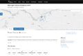 Figure 2Redlight.jpg 1,375 × 926; 162 KB
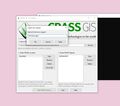 Figure 4Demonstration.jpg 924 × 816; 93 KB
 01-createEnvironment.JPG 724 × 119; 17 KB
 02-createEnvironment.jpg 720 × 393; 78 KB
 Red light camera violations.jpg 970 × 685; 59 KB
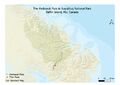 AkshayukPassMap1.1.jpg 3,507 × 2,480; 693 KB
 Figure3QGISStartup.jpg 806 × 800; 101 KB
 QGISCRS.jpg 858 × 861; 130 KB


