Uncategorized files
From CUOSGwiki
Jump to navigationJump to searchShowing below up to 50 results in range #1,651 to #1,700.
View (previous 50 | next 50) (20 | 50 | 100 | 250 | 500)
 Figure 15.jpg 602 × 496; 67 KB
 Figure 15 aspect calculation.png 605 × 559; 62 KB
 Figure 16.jpg 2,104 × 1,070; 306 KB
 Figure 16 aspect from DEM.jpg 1,386 × 981; 338 KB
 Figure 17 hillshade function.png 605 × 556; 68 KB
 Figure 18.jpg 600 × 492; 66 KB
 Figure 18 Hillshade from DEM.jpg 1,386 × 981; 249 KB
 Figure 19.jpg 525 × 125; 25 KB
 Figure 19 3d visualtion of dem from google imagery.png 605 × 354; 157 KB
 Figure 1ScholarsPortal1.jpg 1,607 × 918; 450 KB
 Figure 2!!!.jpg 946 × 902; 367 KB
 Figure 2. Builder software.png 128 × 129; 6 KB
 Figure 2.jpg 705 × 432; 267 KB
 Figure 20.jpg 1,675 × 911; 177 KB
 Figure 20 DEMto3D plugin.png 496 × 804; 24 KB
 Figure 21.jpg 814 × 698; 78 KB
 Figure 21 dem exported as stl file.jpg 1,386 × 980; 109 KB
 Figure 22.jpg 1,119 × 890; 94 KB
 Figure 22 chaanel network aand drainage baasins.png 605 × 724; 107 KB
 Figure 23 r.stream.extract.png 605 × 719; 120 KB
 Figure 24.jpg 208 × 192; 11 KB
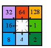 Figure 24 Flow direction example.png 105 × 98; 3 KB
 Figure 25.jpg 1,366 × 1,036; 139 KB
 Figure 25Flow direction.jpg 1,386 × 981; 296 KB
 Figure 26 Contemporary water flow pathways.jpg 1,386 × 981; 290 KB
 Figure 27.jpg 419 × 482; 48 KB
 Figure 27Ancient water flow pathways.jpg 1,386 × 981; 312 KB
 Figure 28Contemporary water flow pathways with flood zones.jpg 1,386 × 981; 314 KB
 Figure 29Ancient water flow pathways with flood zones.jpg 1,386 × 981; 324 KB
 Figure 2Redlight.jpg 1,375 × 926; 162 KB
 Figure 3!!!.jpg 378 × 152; 13 KB
 Figure 3Redlight.jpg 1,384 × 922; 156 KB
 Figure 3 qgis software.png 605 × 319; 65 KB
 Figure 4!!.jpg 543 × 266; 41 KB
 Figure 4Demonstration.jpg 924 × 816; 93 KB
 Figure 4NewDemo.jpg 898 × 765; 97 KB
 Figure 4 DEM.jpg 1,386 × 981; 181 KB
 Figure 5!!!.jpg 1,517 × 881; 589 KB
 Figure 5!!.jpg 452 × 755; 73 KB
 Figure 5.jpg 1,566 × 1,042; 156 KB
 Figure 6Importing.jpg 819 × 210; 41 KB
 Figure 7.jpg 1,312 × 732; 211 KB
 Figure 7 reproject layer for vector data.png 605 × 563; 77 KB
 Figure 8!.jpg 1,042 × 930; 164 KB
 Figure 8ImportingVectors2.jpg 701 × 635; 72 KB
 Figure 8 clip raster by mask layer.png 605 × 563; 111 KB
 Figure 9!!.jpg 886 × 862; 88 KB
 Figure 9.5!.jpg 411 × 355; 28 KB
 Figure 9 DEM merged , clipped and reprojected.jpg 1,386 × 981; 180 KB
 Figure grass.png 700 × 383; 34 KB


