Unused files
From CUOSGwiki
Jump to navigationJump to searchThe following files exist but are not embedded in any page. Please note that other web sites may link to a file with a direct URL, and so may still be listed here despite being in active use.
Showing below up to 50 results in range #301 to #350.
View (previous 50 | next 50) (20 | 50 | 100 | 250 | 500)
- Res1.PNG 1,010 × 532; 142 KB
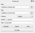
- Length.PNG 300 × 282; 9 KB
- Start.PNG 1,104 × 529; 158 KB
- SpeedLRes.PNG 1,004 × 525; 140 KB
- TimeRes.PNG 1,011 × 511; 137 KB
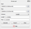
- SpeedL.PNG 302 × 288; 9 KB
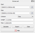
- Time.PNG 296 × 279; 9 KB
- Gloucester.PNG 842 × 601; 47 KB
- Bronson.PNG 975 × 609; 64 KB
- Not.PNG 974 × 605; 71 KB
- Query1.PNG 847 × 601; 28 KB
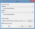
- Clip function.PNG 393 × 329; 11 KB
- Projection.PNG 861 × 659; 50 KB
- Symbology.png 1,366 × 768; 182 KB
- Filter.PNG 612 × 593; 25 KB
- Image003.png 873 × 659; 45 KB
- Image002.png 592 × 385; 35 KB
- Image001.PNG 79 × 80; 4 KB
- Image001.png 79 × 80; 4 KB
- Image004.png 572 × 355; 46 KB
- Image005.png 493 × 242; 10 KB
- Image006.png 682 × 173; 28 KB
- Image007.png 290 × 225; 14 KB
- Image008.png 685 × 175; 29 KB
- Image009.png 1,002 × 592; 31 KB
- Image010.png 1,016 × 639; 51 KB
- Image011.png 1,016 × 639; 60 KB
- Image012.png 1,016 × 639; 51 KB
- Image013.png 1,042 × 639; 42 KB
- Image014.png 1,099 × 639; 51 KB
- Image015.png 666 × 527; 32 KB
- Image016.png 272 × 596; 42 KB
- Image017.png 406 × 329; 21 KB
- Image018.png 805 × 632; 58 KB
- Image019.png 607 × 540; 238 KB
- Image020.png 289 × 339; 22 KB
- Image021.png 1,131 × 186; 21 KB
- Image022.png 1,016 × 639; 42 KB
- Ilwis logo png.png 3,137 × 3,264; 234 KB
- Ilwis Logo.png 197 × 204; 16 KB
- Image43.png 3,507 × 2,480; 2.16 MB
- Add Raster Layer QGIS.png 309 × 295; 51 KB
- ILWIS3.8.3 Interface.png 1,919 × 1,033; 92 KB
- Assign Projection QGIS Raster.png 315 × 385; 27 KB
- QGIS Select desired SRS.png 402 × 692; 32 KB
- Save Raster Layer As QGIS.png 586 × 615; 38 KB
- Import DEM ILWIS.png 433 × 257; 71 KB
- ILWIS Import Window.png 671 × 501; 18 KB
- OkanaganDEM.png 975 × 525; 469 KB
- ManyWaterPoints.png 672 × 544; 517 KB

