Creating service area in QGIS
Contents
Introduction
Network analyst tools comparing the in program tool to a plug in basic how they are different
Data
Finding and downloading data For this tutorial we will be using only open data and open sourced programs. You will need to have QGIS installed to perform this tutorial. All data will come from Open Ottawa Catalogue. The files you will need for this tutorial are:
once all the data is downloaded create a folder in you computer to move all your data files to. Name this new folder something relevant to the tutorial so it is easy to find like NetworkAnalysis_ServiceAreasTutorial. This is to ensure you can easily all the files needed.
uploading data into QGIS
Part 1: QGIS Network analyst tool
What is the network analyst tool how does it work
Creating Service Areas
Network data (deleting some roads)
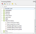
Finding Network analyst tools
setting Network analyst menus output Creating polygons around them ?dissolve output
Part 2: Valhalla Network Analyst tool
What is the Valhalla plug in how does it work
Plugins
Finding plug ins why were using them
Creating Service Areas
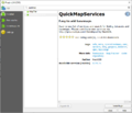
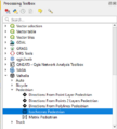
finding Valhalla
creating an account and getting API
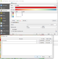
Setting up the menus
output
save as dissolve together
trouble shoot fix geometry set symbology
output
Conclusion
comparing out puts from both tools strengths and weaknesses from both tools uses for these tools and their outputs


