File:Roadnetworkcoordinate.png
From CUOSGwiki
Jump to navigationJump to search
Size of this preview: 800 × 440 pixels. Other resolutions: 320 × 176 pixels | 1,532 × 842 pixels.
Original file (1,532 × 842 pixels, file size: 180 KB, MIME type: image/png)
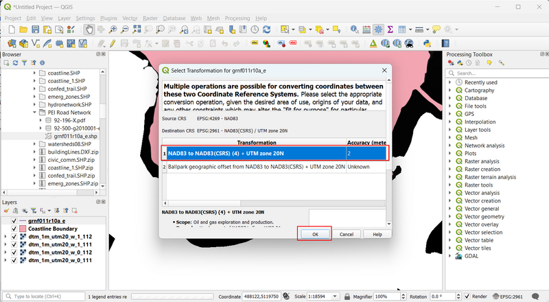
road
File history
Click on a date/time to view the file as it appeared at that time.
| Date/Time | Thumbnail | Dimensions | User | Comment | |
|---|---|---|---|---|---|
| current | 15:32, 21 December 2023 | | 1,532 × 842 (180 KB) | Search (talk | contribs) |
You cannot overwrite this file.
File usage
There are no pages that use this file.