File:AlllayersQGIS.png
From CUOSGwiki
Revision as of 17:51, 6 December 2025 by Harithharison (talk | contribs)

Size of this preview: 800 × 462 pixels. Other resolutions: 320 × 185 pixels | 1,627 × 940 pixels.
Original file (1,627 × 940 pixels, file size: 1.11 MB, MIME type: image/png)
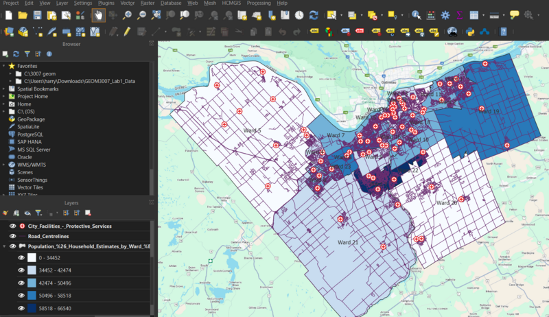
Image of all wards, road networks s and emergency services
File history
Click on a date/time to view the file as it appeared at that time.
| Date/Time | Thumbnail | Dimensions | User | Comment | |
|---|---|---|---|---|---|
| current | 17:51, 6 December 2025 | | 1,627 × 940 (1.11 MB) | Harithharison (talk | contribs) |
You cannot overwrite this file.
File usage
The following page uses this file: