Difference between revisions of "Exploring the Thematic Capabilities of OpenJump"
Stephenplume (talk | contribs) |
Stephenplume (talk | contribs) |
||
| Line 53: | Line 53: | ||
[[File:ehehehe.jpeg]] |
[[File:ehehehe.jpeg]] |
||
| + | Figure 4. This image shows the files that should be selected on the left, and on the right is an image of what the data should will like (Colours may vary) |
||
---- |
---- |
||
Revision as of 01:42, 21 December 2015
Contents
Purpose
The purpose of the tutorial will to demonstrate the thematic capabilities of the open software called OpenJump. It will demonstrate some of the strengths of the program to alter data looking at the styles, symbology, and more. After showing the capabilities of this program, hopefully it helps either students or employers if they want to use this free program to edit their maps, or to buy an official and costly software such as ArcMap.
Introduction
OpenJump is an open source Geographic Information System that has been created by volunteers around the world. The program is capable of analyzing shapefiles and simple GML files, and displays the images. The particular strength of this program is its ability to edit geometry and attribute data which this tutorial will demonstrate. Using datasets provided from the Carleton database, this tutorial will pick data that can be easily understood and displayed on the program and then alter and edit it. This project will use data provided from the City of Ottawa, National Capital Commission, and the Rideau Valley Conservation Authority Thematic Data. These files have provided a number of geospatial datasets that include activities, assets, biophysical, boundaries, mapping, and planning.
Methods
Getting Started
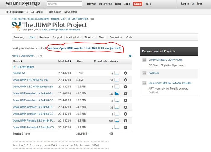
The first step of this tutorial will to first download the software Open Jump. This link will provide the necessary package to open the software: http://sourceforge.net/projects/jump-pilot/files/OpenJUMP/1.8.0/[1]
Figure 1. The red circle shows where you can click to download the software and all of its packages
Collecting the Data
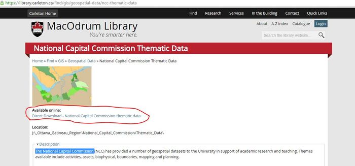
The data that will be used for this tutorial is provided from the National Capital Commission which can be found on the MacOdrum Library website. After finding the data, then download all the files that come with it, save it in your directory and then begin the process of using OpenJump.
Figure 2. This is where you can access the information used in this tutorial
Accessing the data
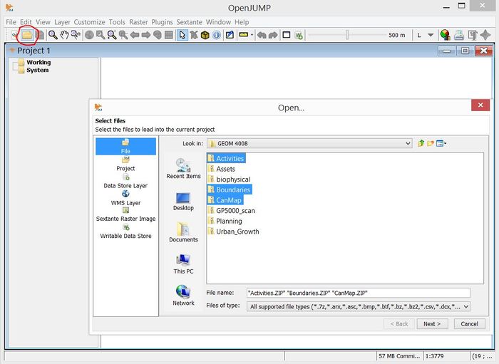
Open up OpenJump, then click on the file in the top left corner of the screen and then locate the downloaded files provided from the National Capital Commission. For this tutorial only the select few layers will be needed: Activities, Boundaries, and CanMap.
Figure 3. The red circle shows where you need to click in order to open and find the files, selecting Activities, Boundaries, and CanMap
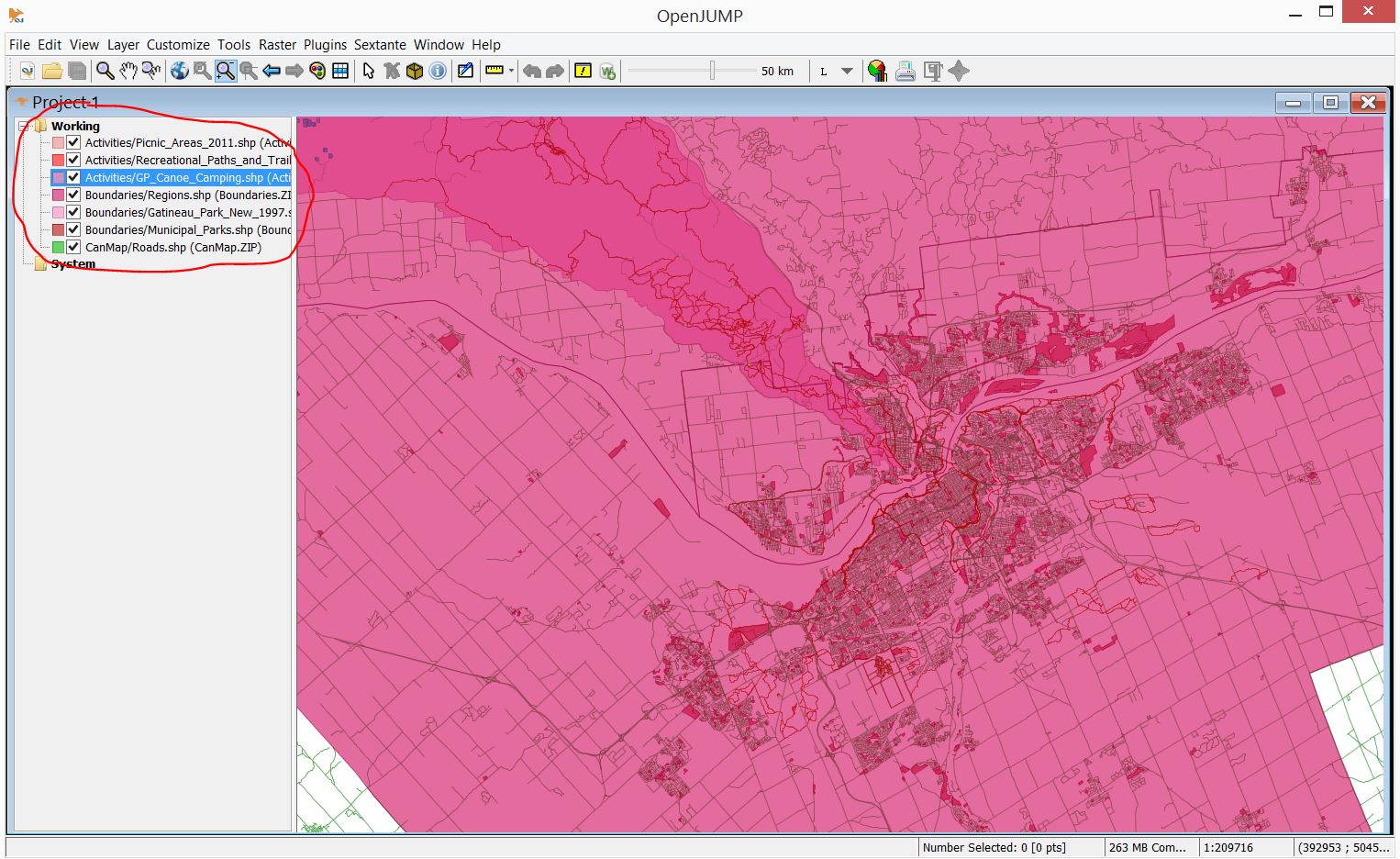
From this step on, you will need to select the files that this tutorial will use to edit which are:
Activities:
- Picnic Areas
- Recreation, Paths, and Trails
- Canoe and Camping
Boundaries:
- Regions
- Gatineau Park
- Municipal Parks
CanMap
- Roads
Figure 4. This image shows the files that should be selected on the left, and on the right is an image of what the data should will like (Colours may vary)


