File:Hq g2.png
From CUOSGwiki
Jump to navigationJump to search
Size of this preview: 800 × 359 pixels. Other resolutions: 320 × 143 pixels | 1,575 × 706 pixels.
Original file (1,575 × 706 pixels, file size: 456 KB, MIME type: image/png)
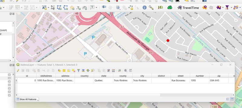
A screenshot showing the output of the Hqgis Geocoding tool. The point is shown in red and the attribute table has been opened to show the generated attribute information.
File history
Click on a date/time to view the file as it appeared at that time.
| Date/Time | Thumbnail | Dimensions | User | Comment | |
|---|---|---|---|---|---|
| current | 15:31, 19 December 2023 | | 1,575 × 706 (456 KB) | AHoferek (talk | contribs) |
You cannot overwrite this file.
File usage
The following page uses this file: