Uncategorized files
From CUOSGwiki
Jump to navigationJump to searchShowing below up to 500 results in range #1 to #500.
View (previous 500 | next 500) (20 | 50 | 100 | 250 | 500)
 (example 1).png 671 × 502; 21 KB
 +.png 28 × 30; 1 KB
 01-createEnvironment.JPG 724 × 119; 17 KB
 01-createEnvironment.jpg 724 × 119; 17 KB
 02-createEnvironment.jpg 720 × 393; 78 KB
 03-activateEnvironment.jpg 732 × 41; 15 KB
 04-homeVariable.jpg 732 × 58; 22 KB
 1.PNG 570 × 211; 33 KB
 1.jpg 326 × 97; 8 KB
 1.tif 266 × 733; 72 KB
 10.jpeg 280 × 354; 36 KB
 10.jpg 480 × 792; 157 KB
 1011.jpeg 813 × 184; 90 KB
 10 Merge.png 997 × 379; 57 KB
 10 VectWatershed.png 535 × 392; 67 KB
 10 nbhd points count.png 850 × 201; 40 KB
 10m Sea Level.jpg 5,846 × 4,133; 544 KB
 11.jpg 1,154 × 564; 103 KB
 11 Clip.png 997 × 392; 63 KB
 11 FinalWatershed.png 1,076 × 672; 366 KB
 11 sample merged results.png 1,050 × 281; 49 KB
 12.jpg 482 × 793; 74 KB
 12 FieldCalc.png 1,046 × 630; 79 KB
 12 stats.png 670 × 146; 25 KB
 13.jpg 715 × 793; 425 KB
 13 ModelMade.png 1,111 × 706; 70 KB
 13 facet map.png 980 × 901; 214 KB
 14.jpg 1,156 × 565; 97 KB
 143.PNG 647 × 653; 1.22 MB
 143selection.JPG 431 × 307; 28 KB
 14 1to1 plot.png 1,000 × 951; 160 KB
 14 SaveRun.png 1,112 × 110; 30 KB
 15.jpg 466 × 768; 76 KB
 15 SetLayers.png 728 × 462; 124 KB
 16.jpg 486 × 795; 225 KB
 16 ModelRunning.png 591 × 442; 77 KB
 17.jpg 1,155 × 565; 113 KB
 17 ResultsVModel.png 1,225 × 766; 625 KB
 18.jpg 1,155 × 565; 112 KB
 19.jpg 480 × 793; 141 KB
 1BeforeHistorgramScaling.JPG 808 × 839; 198 KB
 1Proj4command line.png 405 × 540; 29 KB
 1Proj4commandline.png 1,680 × 1,050; 237 KB
 1 AddLayer.png 649 × 286; 65 KB
 1 AddLayerDialog.png 495 × 243; 13 KB
 1 DEM.png 350 × 581; 159 KB
 1 DataAdded.png 981 × 613; 384 KB
 1 DataPanel UnnamedGrids.png 418 × 540; 64 KB
 1 compare random samples.png 1,180 × 181; 43 KB
 1 sinking.png 841 × 650; 60 KB
 1a.jpg 861 × 762; 124 KB
 1creatingwatershed.png 280 × 294; 11 KB
 1morphometry.png 1,680 × 1,050; 237 KB
 1sinking.png 1,680 × 1,050; 230 KB
 1upslopearea.png 262 × 372; 14 KB
 2.PNG 704 × 460; 38 KB
 2.jpg 482 × 794; 121 KB
 20.jpg 481 × 790; 146 KB
 2004.png 1,376 × 807; 301 KB
 2006 2016Qgis.PNG 1,118 × 776; 115 KB
 2016Script.PNG 889 × 533; 49 KB
 2019 NO2 Baseline Level Map.png 1,306 × 523; 550 KB
 2020 NO2 Map.png 1,288 × 484; 540 KB
 21.jpg 599 × 448; 70 KB
 22.jpg 625 × 651; 96 KB
 23.jpg 625 × 650; 93 KB
 24.jpg 665 × 536; 78 KB
 25.jpg 591 × 553; 66 KB
 26.jpg 498 × 820; 160 KB
 261373571 4617320898304073 5462985204813230109 n.jpg 1,170 × 876; 170 KB
 261398404 4669993196424112 4824757652277001506 n.jpg 1,170 × 876; 188 KB
 262827258 888099625215407 8233540035700652179 n.jpg 1,920 × 1,080; 431 KB
 263357944 613230896496083 212413682085358965 n.jpg 1,080 × 1,920; 407 KB
 267158918 225787749703954 6548793805594843962 n.png 1,920 × 1,080; 942 KB
 27.jpg 610 × 567; 90 KB
 28.jpg 549 × 912; 352 KB
 29.jpg 814 × 542; 79 KB
 2AfterHistorgramScaling.JPG 823 × 853; 169 KB
 2Commands.png 571 × 526; 63 KB
 2 DataPanel NamedGrids.png 419 × 542; 47 KB
 2 GM.png 735 × 463; 79 KB
 2 MakingMask.png 754 × 707; 317 KB
 2 ToolBox Advanced.png 482 × 209; 33 KB
 2 plot the geometries.png 1,700 × 501; 222 KB
 2 wanglui.png 1,190 × 250; 28 KB
 2dMap(Updated).jpg 3,507 × 2,480; 1.92 MB
 2dmap.jpg 3,507 × 2,480; 1.91 MB
 2dmodel.gif 338 × 237; 1.26 MB
 2geesignup.png 667 × 1,080; 102 KB
 2mContours.JPG 585 × 557; 101 KB
 2sagawetnessindex.png 1,186 × 719; 63 KB
 2slopecurvatureaspect.png 1,189 × 721; 61 KB
 2source parameters.png 1,183 × 284; 35 KB
 2sourceparameters.png 1,680 × 1,050; 302 KB
 2threejs.png 1,276 × 785; 66 KB
 2threejs2.png 760 × 101; 26 KB
 2threejs3.png 720 × 536; 44 KB
 2upslopearea.png 1,188 × 718; 64 KB
 2wanglui.png 1,680 × 1,050; 273 KB
 3.jpg 481 × 793; 278 KB
 30.jpg 1,046 × 929; 354 KB
 31.jpg 881 × 487; 112 KB
 32.jpg 915 × 585; 112 KB
 321.jpg 1,365 × 681; 431 KB
 322.PNG 31 × 31; 987 bytes
 322.jpg 31 × 31; 1 KB
 33.jpg 548 × 910; 273 KB
 34.jpg 552 × 914; 172 KB
 35.jpg 768 × 385; 79 KB
 36.JPG 918 × 595; 63 KB
 36.jpg 550 × 909; 91 KB
 367.JPG 874 × 868; 301 KB
 37.jpg 845 × 371; 74 KB
 38.jpg 550 × 912; 283 KB
 39.jpg 619 × 421; 83 KB
 3Commands.png 573 × 530; 70 KB
 3D.png 1,017 × 639; 61 KB
 3DPlotting.png 799 × 246; 16 KB
 3 Clipping.png 1,059 × 662; 407 KB
 3 GMwLayers.png 1,113 × 239; 30 KB
 3 InsertParameter.png 249 × 282; 8 KB
 3 Orbview ChangeToGreyscale.png 1,503 × 928; 173 KB
 3 sample merged results.png 950 × 298; 49 KB
 3cell size.png 1,188 × 256; 29 KB
 3cellsize.png 1,680 × 1,050; 291 KB
 3dand2d.gif 353 × 237; 1.71 MB
 3dmodel.gif 297 × 212; 1.88 MB
 3dmodelfront.jpg 2,298 × 1,331; 245 KB
 3dmodelmiddle.jpg 2,285 × 1,319; 340 KB
 3dmodelside.jpg 2,298 × 1,331; 509 KB
 3m Sea Level.jpg 5,846 × 4,133; 566 KB
 4-3-2.JPG 171 × 37; 10 KB
 4.jpg 818 × 562; 59 KB
 40.jpg 619 × 421; 84 KB
 4008Map1.png 1,205 × 851; 154 KB
 41.jpg 551 × 910; 219 KB
 411.jpg 240 × 330; 33 KB
 412.jpg 864 × 377; 70 KB
 42.jpg 550 × 909; 240 KB
 421.jpg 881 × 455; 124 KB
 422.jpg 398 × 371; 58 KB
 424.jpg 334 × 483; 56 KB
 43.jpg 483 × 371; 59 KB
 431a.jpg 400 × 317; 45 KB
 432.jpg 379 × 345; 59 KB
 44.jpg 550 × 336; 54 KB
 441.jpg 399 × 305; 37 KB
 442.jpg 516 × 38; 10 KB
 443.jpg 393 × 393; 81 KB
 444.jpg 382 × 348; 61 KB
 445.JPG 418 × 472; 48 KB
 446.JPG 556 × 229; 29 KB
 4 ClipResult.png 340 × 572; 160 KB
 4 Landsat8MS RGBcomposite.png 535 × 913; 109 KB
 4 stats.png 700 × 141; 27 KB
 4setcoordinatesystem.png 396 × 540; 18 KB
 5.jpg 1,025 × 562; 101 KB
 5 Brovey IHS ToolInputs.png 716 × 338; 57 KB
 5 RasterModel.png 975 × 677; 140 KB
 5 facet map.png 1,000 × 901; 227 KB
 5x5AVGx10.png 927 × 794; 55 KB
 5x5AVGx15.png 962 × 804; 54 KB
 5x5AVGx5.png 935 × 798; 59 KB
 6.jpg 741 × 789; 226 KB
 6 FillSinks.png 535 × 392; 48 KB
 6 Spectral PC ToolInputs.png 717 × 684; 81 KB
 6 explore map.png 1,328 × 803; 1.95 MB
 7.jpg 1,209 × 714; 108 KB
 71.JPG 868 × 283; 95 KB
 7 1to1 plot.png 990 × 951; 180 KB
 7 All Methods Comparison.png 1,514 × 513; 1 MB
 7 CatchmentArea.png 533 × 399; 61 KB
 8.jpg 481 × 790; 214 KB
 8 ChannelNetwork.png 535 × 393; 77 KB
 8 FindTool.png 323 × 395; 35 KB
 8 Rise2.JPG 1,165 × 888; 240 KB
 8 ct points count.png 690 × 201; 35 KB
 8m Rise.JPG 717 × 601; 99 KB
 9.jpg 945 × 563; 98 KB
 96.JPG 534 × 608; 55 KB
 9 Buffer.png 664 × 486; 37 KB
 9 WatershedBasins.png 535 × 393; 68 KB
 9 da points count.png 780 × 197; 37 KB
 9mFLood.png 1,133 × 544; 372 KB
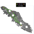
 A+B+C+D.png 314 × 204; 13 KB
 A.jpg 669 × 307; 31 KB
 ADDCSV.PNG 308 × 288; 81 KB
 ADDING A PHOTO.png 928 × 990; 755 KB
 ADDSHP.png 1,063 × 834; 327 KB
 ADDSHP2.png 340 × 345; 94 KB
 ADDSHP3.png 501 × 271; 39 KB
 ADDTL.png 41 × 39; 1 KB
 ADpath&cor.png 476 × 386; 44 KB
 AHResults9.png 370 × 286; 172 KB
 AIWebsite.JPG 1,912 × 863; 293 KB
 ALLRFsettings.png 976 × 626; 26 KB
 AOI.png 484 × 353; 27 KB
 AOI2.PNG 1,376 × 1,090; 193 KB
 AOIMap.jpg 215 × 216; 19 KB
 AOIOttawa.PNG 1,917 × 1,040; 395 KB
 AOI NO2 Example.png 1,800 × 1,078; 1.94 MB
 AOIclip.png 503 × 475; 37 KB
 API.png 418 × 276; 10 KB
 APPEARANCE.JPG 421 × 588; 44 KB
 ASCIIInputFormatTab.PNG 462 × 493; 17 KB
 ASCIIPointsTab.PNG 462 × 493; 25 KB
 ASCIIRequiredTab.PNG 462 × 493; 30 KB
 ASCII Points.JPG 470 × 498; 61 KB
 ASCII Required.JPG 470 × 495; 47 KB
 ASmap.png 1,429 × 1,009; 2 MB
 AT.png 774 × 350; 196 KB
 ATCOR.jpg 1,745 × 1,003; 597 KB
 ATTB.png 1,526 × 776; 212 KB
 ATTBCT.png 713 × 390; 172 KB
 AT 1.png 1,164 × 588; 78 KB
 AaalmostThere.JPG 1,721 × 1,004; 298 KB
 Abenk3.PNG 1,083 × 869; 1.54 MB
 Abenk4.PNG 526 × 531; 27 KB
 AbenkDEM.png 505 × 876; 41 KB
 AbenkHill.png 630 × 862; 615 KB
 AbenkNoMosaic.png 589 × 889; 361 KB
 AccidentTypes.PNG 1,353 × 804; 350 KB
 AccidentsBarrhaven.PNG 378 × 350; 12 KB
 Accidentsrailway.PNG 625 × 657; 228 KB
 AccumFlow1.png 847 × 759; 171 KB
 Accumulated cost with points.PNG 532 × 913; 351 KB
 Accumulation Cost.png 1,177 × 263; 19 KB
 Accuracy assessment.JPG 1,116 × 627; 156 KB
 Action.JPG 41 × 43; 8 KB
 Action button.PNG 1,242 × 682; 790 KB
 Action tool.png 117 × 31; 1 KB
 Add.jpeg 902 × 879; 174 KB
 Add.png 902 × 879; 327 KB
 AddAbenk.png 917 × 503; 107 KB
 AddCSV.png 689 × 426; 77 KB
 AddCSVya.png 902 × 509; 210 KB
 AddColumn.png 34 × 31; 1 KB
 AddDEM.PNG 598 × 435; 36 KB
 AddData.jpg 1,677 × 1,008; 245 KB
 AddData.png 359 × 214; 21 KB
 AddDelimitedTextLayer.png 1,920 × 1,080; 224 KB
 AddFeature.jpg 36 × 36; 9 KB
 AddField.JPG 204 × 45; 11 KB
 AddIcon.PNG 53 × 44; 1 KB
 AddLayer.png 1,920 × 1,080; 240 KB
 AddLegend.jpg 1,042 × 666; 102 KB
 AddMap.png 29 × 29; 632 bytes
 AddPolygonsToMap.JPG 389 × 237; 22 KB
 AddRaster.jpg 40 × 38; 8 KB
 AddRasterData.JPG 817 × 454; 82 KB
 AddRasterLayer.jpg 412 × 356; 55 KB
 AddShape.JPG 772 × 731; 97 KB
 AddVector.png 517 × 697; 46 KB
 AddVectorLayer.png 1,920 × 1,080; 240 KB
 Add Field.png 620 × 106; 21 KB
 Add Fields.png 752 × 580; 55 KB
 Add Polygon Feature Button.png 32 × 31; 1 KB
 Add Raster Layer.png 42 × 43; 765 bytes
 Add Raster Layer QGIS.png 309 × 295; 51 KB
 Add Vector.jpg 37 × 37; 9 KB
 Add Vector Layer.PNG 42 × 35; 1 KB
 Add column tool.png 1,324 × 674; 346 KB
 Add field.JPG 312 × 235; 20 KB
 Add grass vector.bmp 297 × 165; 144 KB
 Add map feature button.png 72 × 66; 6 KB
 Add map features.png 460 × 316; 47 KB
 Add new grid to after fire.png 473 × 245; 18 KB
 Add new grid to new map.png 277 × 103; 5 KB
 Add point.jpg 29 × 27; 755 bytes
 Add points action tool.PNG 864 × 596; 113 KB
 Add raster.jpeg 42 × 43; 1 KB
 Add raster.jpg 42 × 43; 1 KB
 Add raster button.jpg 31 × 30; 1 KB
 Add to map.JPG 600 × 394; 48 KB
 Add vector.png 1,002 × 283; 52 KB
 Add vector layer QGIS.png 908 × 579; 99 KB
 Addbutton.jpg 26 × 26; 8 KB
 Addcolumn.png 275 × 268; 23 KB
 Added bus.JPG 1,920 × 1,012; 487 KB
 Addfeaturetab.png 38 × 32; 886 bytes
 Addfield.png 2,150 × 1,216; 162 KB
 Adding Fields.png 1,784 × 709; 201 KB
 Adding a media section.jpg 1,687 × 686; 145 KB
 Adding a point.PNG 489 × 236; 13 KB
 Adding a title image.jpg 1,102 × 566; 51 KB
 Adding a web page section.jpg 1,646 × 717; 225 KB
 Adding shapefiles to map in SAGA.png 507 × 731; 144 KB
 Addingdata2.png 669 × 499; 235 KB
 AdditionalCriteria.jpg 522 × 900; 129 KB
 Additionals.png 694 × 451; 74 KB
 Additionalstats.png 996 × 649; 98 KB
 Addjoin.png 981 × 693; 55 KB
 Addnewmap.jpg 43 × 48; 1 KB
 Addpnt1.png 24 × 24; 970 bytes
 Addpointfeature.png 35 × 34; 724 bytes
 AddpointtomapSAGA.png 463 × 611; 23 KB
 Addraslayer.png 32 × 31; 1 KB
 Addraster.jpg 42 × 43; 1 KB
 Addrasterlayer1.png 358 × 522; 33 KB
 AddshapeSAGA.png 596 × 696; 161 KB
 Addshape to map projection layer.png 1,920 × 1,026; 1,011 KB
 AddtoMap7.png 212 × 149; 9 KB
 Addveclayer.png 34 × 36; 2 KB
 Addvector.png 1,366 × 768; 187 KB
 Addvector2.png 492 × 241; 18 KB
 Addwater.jpg 566 × 500; 39 KB
 Adjust color.jpg 831 × 814; 68 KB
 Adjusted pie chart.png 1,046 × 721; 76 KB
 AdvancedColours.png 651 × 424; 18 KB
 After.JPG 1,612 × 837; 326 KB
 AfterAtt.png 479 × 295; 33 KB
 AfterFloods.png 1,138 × 554; 372 KB
 After Fire new Composite colouring.png 825 × 627; 999 KB
 After extract.png 2,375 × 954; 664 KB
 After fire Final.png 955 × 704; 1.39 MB
 After fire both data sets uploaded.png 1,577 × 723; 731 KB
 Agreement sign.png 978 × 672; 53 KB
 Ahjv.jpg 1,920 × 913; 137 KB
 AkshayukPassMap1.1.jpg 3,507 × 2,480; 693 KB
 AkshayukPassMapGoodMattNick.jpg 3,507 × 2,480; 807 KB
 Albedo.JPG 870 × 852; 332 KB
 Albedo14to17.PNG 1,300 × 172; 59 KB
 Albedo snap.JPG 864 × 860; 313 KB
 Albedoresult.PNG 555 × 65; 3 KB
 AllBuffers.PNG 1,519 × 836; 140 KB
 AllPaths MastCostRast.PNG 865 × 704; 260 KB
 AllPaths MastCostRast2.PNG 543 × 451; 119 KB
 AllPaths MastCostRast3.PNG 374 × 377; 68 KB
 Allsetup.png 624 × 722; 114 KB
 AlmostThere.JPG 1,072 × 918; 243 KB
 Anacondafig1.jpg 427 × 258; 11 KB
 AnalyticalHillshade6.png 482 × 252; 24 KB
 Andre01.jpg 1,920 × 1,080; 577 KB
 Andre02.jpg 1,200 × 693; 83 KB
 Andre03.jpg 1,543 × 867; 277 KB
 Animated bananashooter.gif 307 × 224; 1.43 MB
 Animation.gif 150 × 190; 22 KB
 AnnualRainfallGeologyIntersection.JPG 682 × 549; 60 KB
 AnnualRainfallGeologySoilsIntersectionImage.JPG 686 × 549; 59 KB
 AnnualRainfallSelect.JPG 760 × 869; 105 KB
 Aoi.png 821 × 439; 404 KB
- Aoi complete Project Polygon2.tif 3,355 × 2,074; 622 KB
 Aoi final 1.png 1,510 × 837; 149 KB
 Api.png 429 × 308; 31 KB
 App thumbnail.jpg 725 × 246; 30 KB
 ApplyCoordSystem 1.png 1,416 × 760; 161 KB
 ApplyCoordSystem 2.png 698 × 760; 66 KB
 ApplyCoordSystem 3.png 700 × 768; 89 KB
 ArcSymbology.PNG 664 × 555; 18 KB
 Arccolour.png 512 × 504; 31 KB
 Arcmaptitle.jpg 455 × 269; 14 KB
 Area, extent, of shapefile.png 410 × 234; 10 KB
 Area.png 532 × 235; 57 KB
 Area of Interest.jpg 1,920 × 1,080; 329 KB
 Area of Interest 1.jpg 1,920 × 956; 436 KB
 Areas in blue = suitable (wetland+water).png 1,487 × 915; 434 KB
 Areas in green = suitable (forest + urban).png 1,488 × 922; 386 KB
 Asf ajl.png 931 × 1,004; 129 KB
 Asf images ajl.png 960 × 912; 723 KB
 Aspect.bmp 418 × 509; 624 KB
 Aspect.png 602 × 767; 429 KB
 Aspect1.png 656 × 572; 480 KB
 Aspect12.png 487 × 361; 449 KB
 AspectAlg.png 1,016 × 638; 88 KB
 AspectR.png 1,852 × 180; 45 KB
 AspectTM.png 1,068 × 719; 1.39 MB
 Aspect Map.jpg 400 × 399; 143 KB
 Aspectnhm.jpg 789 × 518; 185 KB
 Aspectresfinal.png 779 × 547; 501 KB
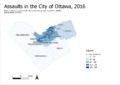 Assaultsmap.png 849 × 599; 89 KB
 Assign Projection QGIS Raster.png 315 × 385; 27 KB
 Assigntobuildings.png 713 × 342; 14 KB
 Attclass.png 108 × 65; 1 KB
 Attrib1.png 780 × 438; 189 KB
 Attribute.png 1,231 × 607; 85 KB
 Attribute File.jpg 1,440 × 900; 435 KB
 Attribute Table Properties.PNG 1,053 × 604; 56 KB
 Attribute table.bmp 1,057 × 603; 1.82 MB
 Attributes.jpg 1,680 × 1,010; 536 KB
 Attributes grif.jpg 1,055 × 602; 116 KB
 Attributetable.png 117 × 173; 4 KB
 Attributetbl.png 706 × 39; 1 KB
 AustriaDEMPic.JPG 1,478 × 821; 102 KB
 Authentication Earth Engine Code Example.png 527 × 525; 12 KB
 Authentication of Earth Engine in Colab.png 1,711 × 305; 30 KB
 Author in the field.JPG 2,448 × 3,264; 1.45 MB
 B.png 27 × 23; 704 bytes
 B2.png 33 × 21; 664 bytes
 B3.png 31 × 22; 962 bytes
 B4.png 36 × 30; 876 bytes
 B5.png 39 × 26; 1 KB
 BAND214.PNG 1,215 × 588; 1.08 MB
 BC Vectorized.png 714 × 553; 28 KB
 BC data extraction.png 1,004 × 260; 74 KB
 BEDROCK RAST.png 690 × 525; 10 KB
 BIWEEKLY.png 960 × 540; 332 KB
 BTA1.png 356 × 328; 10 KB
 BabelFiletoDevice.png 1,326 × 1,182; 129 KB
 BabelFiletoFile.png 1,328 × 1,160; 134 KB
 BadClassification.png 533 × 286; 13 KB
 Band121.JPG 859 × 869; 303 KB
 Band146.JPG 805 × 795; 254 KB
 Band1inWindow.jpg 794 × 397; 61 KB
 Band214setup.PNG 422 × 298; 13 KB
 BandSettings.png 2,544 × 1,190; 650 KB
 Band 10.JPG 957 × 817; 31 KB
 Band wavelength.JPG 303 × 238; 22 KB
 Bandmath123.JPG 746 × 348; 44 KB
 Barchart.png 1,240 × 531; 41 KB
 Barrhaven.PNG 544 × 414; 139 KB
 Barrhaven1.png 672 × 603; 333 KB
 BarrhavenClip.png 763 × 752; 280 KB
 BarrhavenClipped.PNG 679 × 623; 240 KB
 BarrhavenandNewBarrhaven.png 1,680 × 1,050; 362 KB
 Base and Post Fire NBR Results.png 556 × 660; 546 KB
 Baseline Normalized Burn Ratio.png 829 × 449; 589 KB
 Basemap.PNG 811 × 593; 342 KB
 Basemapplugin.PNG 793 × 682; 39 KB
 BasicContourCode.png 753 × 49; 5 KB
 BasicContours.png 479 × 395; 7 KB
 BatchClip.jpg 1,917 × 1,038; 568 KB
 Batch ajl.PNG 32 × 29; 472 bytes
 BedRockRaster.bmp 636 × 468; 872 KB
 Bedrock.png 690 × 525; 10 KB
 Before.JPG 1,598 × 902; 348 KB
 BeforeAtt.png 477 × 298; 33 KB
 BeforeClassification.png 920 × 862; 1.69 MB
 BeforeFloods.png 1,134 × 544; 571 KB
 BeforeMerge.PNG 1,919 × 1,077; 659 KB
 BeforeReorder.jpg 736 × 540; 53 KB
 Before Fire Final.png 951 × 701; 1.33 MB
 Before and After fire mosaics.png 798 × 487; 273 KB
 Before extract.png 2,389 × 1,168; 804 KB
 Before processing.JPG 1,402 × 718; 101 KB
 BeforeafterCI.png 1,308 × 600; 1.74 MB
 Beforeandafter.png 1,416 × 840; 630 KB
 BeginnningSearch.png 1,866 × 735; 215 KB
 BetterClassification.png 533 × 286; 19 KB
 Big pie chart.png 782 × 559; 56 KB
 Bigarea.jpg 569 × 552; 71 KB
 Bigpark newcolor.JPG 817 × 597; 185 KB
 Bigparks Attribute.JPG 699 × 550; 113 KB
 Bigparks Display.JPG 815 × 598; 117 KB
 Blahblahblah.jpeg 1,319 × 616; 97 KB
 BlankOutletRaster.PNG 391 × 435; 32 KB
 BlankOutletRasterMsg.PNG 800 × 400; 48 KB
 Bljblj.jpeg 627 × 913; 96 KB
 Blogblogblog.jpeg 1,100 × 803; 109 KB
 Bobcaygeon.PNG 1,131 × 512; 1.6 MB
 BobcaygeonClassified.PNG 805 × 362; 58 KB
 Bobobob.jpeg 669 × 573; 86 KB
 Boop capture.jpg 271 × 480; 33 KB
 Bot1.jpg 266 × 733; 84 KB
 Bot10.jpg 628 × 370; 60 KB
 Bot11.jpg 628 × 341; 46 KB
 Bot12.jpg 628 × 341; 101 KB
 Bot2.jpg 628 × 480; 90 KB
 Bot3.jpg 255 × 277; 27 KB
 Bot4.jpg 627 × 297; 51 KB
 Bot5.jpg 226 × 138; 12 KB
 Bot6.jpg 628 × 374; 59 KB
 Bot7.jpg 628 × 236; 51 KB
 Bot8.jpg 628 × 409; 62 KB
 Bot9.jpg 628 × 370; 46 KB
 Boundary.png 104 × 46; 2 KB
 Boundarypoints.png 429 × 359; 36 KB
 Boundarypoints2.png 502 × 423; 47 KB
 Boundingboxcode.png 583 × 80; 6 KB
 Break&Entry 2019.jpg 3,507 × 2,480; 618 KB
 Break&Entry 2019 2.jpg 3,507 × 2,480; 826 KB
 Break ins, 2010.png 804 × 580; 101 KB
 Break ins 2016.png 799 × 567; 82 KB
 Break ins stats.png 688 × 558; 29 KB
 Breakin2013.png 787 × 573; 93 KB
 Bronson.PNG 975 × 609; 64 KB
 Browse.png 82 × 29; 830 bytes
 BrowseBotton.png 22 × 34; 438 bytes
 Browsetoreclass.png 468 × 68; 2 KB
 Browsing Files.PNG 938 × 583; 44 KB
 Buffed water.bmp 670 × 536; 1.03 MB
 Buffer.png 603 × 505; 112 KB
 Buffer1.png 448 × 308; 122 KB
 Buffer2.bmp 336 × 344; 339 KB
 Buffer2.png 336 × 344; 56 KB
 Buffer2r.png 393 × 338; 75 KB
 Buffer3.png 432 × 336; 126 KB
 Buffer4.png 399 × 336; 42 KB
 BufferFinal VorarlbergSlopeGT25.JPG 692 × 556; 69 KB
 BufferLandUseWindow.JPG 684 × 552; 62 KB
 BufferMelinda.PNG 381 × 399; 15 KB
 BufferRailwaysToolWindow.jpg 837 × 378; 60 KB
 BufferTool.JPG 684 × 557; 65 KB
 BufferToolWindow.JPG 684 × 557; 65 KB
 BufferWindow.png 690 × 507; 40 KB
 Buffer overlay.bmp 550 × 409; 660 KB
 BufferandClip.PNG 628 × 645; 231 KB
 BufferlocationSAGA.png 718 × 637; 40 KB
 BuffersettingsSAGA.png 756 × 370; 15 KB
 Buffertool.jpg 830 × 511; 48 KB
 Building Name.png 1,365 × 910; 101 KB
.png)


.jpg)


.png)
.png)


