Unused files
From CUOSGwiki
Jump to navigationJump to searchThe following files exist but are not embedded in any page. Please note that other web sites may link to a file with a direct URL, and so may still be listed here despite being in active use.
Showing below up to 100 results in range #1 to #100.
View (previous 100 | next 100) (20 | 50 | 100 | 250 | 500)
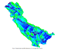 5x5AVGx5.png 935 × 798; 59 KB
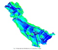 5x5AVGx10.png 927 × 794; 55 KB
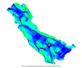 5x5AVGx15.png 962 × 804; 54 KB
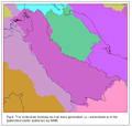 WatershedVerification.png 716 × 688; 47 KB
 TopoVarification1.png 895 × 677; 218 KB
 TopoVarification2.png 900 × 645; 204 KB
 Figure1.pdf ; 27 KB
 Figure1.jpg 299 × 98; 21 KB
 Postgres client.png 658 × 437; 29 KB
 New mapset.bmp 32 × 27; 3 KB
 Fig2.png 590 × 426; 48 KB
 Grass tools.bmp 32 × 29; 3 KB
 Grass vector.bmp 33 × 30; 3 KB
 Add grass vector.bmp 297 × 165; 144 KB
 ColorRules.png 680 × 126; 7 KB
 Rail power buffer.bmp 1,062 × 400; 1.22 MB
 Road buffer.bmp 576 × 423; 714 KB
 Buffer overlay.bmp 550 × 409; 660 KB
 Overlay tool.bmp 517 × 490; 743 KB
 Figure2.jpg 705 × 432; 87 KB
 Region of interest.bmp 525 × 302; 465 KB
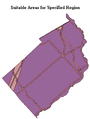 Specific area.bmp 310 × 411; 374 KB
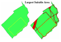 Largest area.bmp 365 × 252; 270 KB
 Visual.jpg 1,434 × 810; 222 KB
 Figure.jpg 553 × 613; 67 KB
 GrassStart.jpg 277 × 307; 22 KB
 GrassStart2.jpg 375 × 192; 11 KB
 GrassStart4.jpg 407 × 210; 12 KB
 VectorImport1.bmp 545 × 384; 614 KB
 OpenOffice2.bmp 491 × 232; 334 KB
 OpenOffice.bmp 491 × 232; 334 KB
 QGISGrassRegion.bmp 432 × 328; 415 KB
 QGISGrassShell.bmp 664 × 141; 274 KB
 LandUseRaster.bmp 637 × 470; 878 KB
 BedRockRaster.bmp 636 × 468; 872 KB
 QGISGrassSymbology.bmp 526 × 360; 556 KB
 LandUseSuitabilityMap.bmp 642 × 472; 889 KB
 LandAllocationMap.bmp 659 × 486; 940 KB
 Icon2.bmp 36 × 36; 4 KB
 Figure 1.png 81 × 106; 14 KB
 Figure 1.jpg 81 × 106; 2 KB
 Figure x1.jpg 81 × 106; 2 KB
 Pic1.png 81 × 106; 14 KB
 Pic2.jpg 802 × 555; 31 KB
 Pic3.png 108 × 65; 10 KB
 Pic3 2.png 162 × 84; 16 KB
 Pic4.png 545 × 208; 57 KB
 Pic5.png 273 × 158; 31 KB
 Pic6.png 447 × 520; 122 KB
 Pic7.png 406 × 478; 201 KB
 Pic8.png 293 × 155; 27 KB
 Pic9.png 278 × 248; 49 KB
 Wolf.png 452 × 383; 372 KB
 Wolf1.png 222 × 198; 113 KB
 Pluginm.png 184 × 120; 21 KB
 Plugin2.png 167 × 112; 18 KB
 OpenMapset.png 120 × 28; 4 KB
 Addcolumn.png 275 × 268; 23 KB
 Browsetoreclass.png 468 × 68; 2 KB
 Masterraster1.png 605 × 807; 135 KB
 FINALMASTERRASTER.png 1,019 × 840; 133 KB
 Coriddor&Path.png 485 × 388; 45 KB
 Rdrain2.png 217 × 219; 2 KB
 FINALOUTPUTMAP.png 462 × 377; 50 KB
 Boundarypoints.png 429 × 359; 36 KB
 RasterCostRaster.png 650 × 883; 162 KB
 Picture1001.png 650 × 884; 162 KB
 Capture1001.png 687 × 457; 139 KB
 Picture1002.png 2,057 × 1,302; 680 KB
 Picture1003.png 1,703 × 927; 420 KB
 Picture1004.png 1,290 × 668; 253 KB
 Presentation1.jpg 720 × 960; 20 KB
 AllPaths MastCostRast.PNG 865 × 704; 260 KB
 AllPaths MastCostRast2.PNG 543 × 451; 119 KB
 AllPaths MastCostRast3.PNG 374 × 377; 68 KB
 Northsea.png 1,379 × 827; 597 KB
 Animated bananashooter.gif 307 × 224; 1.43 MB
 Directory download paint.jpg 472 × 738; 118 KB
 Originaldatamap.JPG 652 × 603; 79 KB
 AddRaster.jpg 40 × 38; 8 KB
 TOC.jpg 258 × 107; 20 KB
 Greywolf.jpg 620 × 349; 123 KB
 Merge DEM.jpg 279 × 407; 55 KB
 Setrisesun.gif 500 × 248; 466 KB
 Waves.gif 500 × 206; 499 KB
 AddColumn.png 34 × 31; 1 KB
 FC.png 33 × 31; 969 bytes
 WHfield2.png 100 × 111; 2 KB
 QuickStartOSGeo4w.png 597 × 327; 26 KB
 File-report.png 325 × 201; 5 KB
 BIWEEKLY.png 960 × 540; 332 KB
 OCT1&2.PNG 960 × 540; 315 KB
 OCT3&4.PNG 960 × 540; 317 KB
 NOV1&2.PNG 960 × 540; 319 KB
 NOV3&4.PNG 960 × 540; 313 KB
 OCT2012.PNG 960 × 540; 348 KB
 NOV2012.PNG 960 × 540; 346 KB
 OCT3&44.PNG 960 × 540; 331 KB
 TXT.png 960 × 540; 337 KB
 TM.png 960 × 540; 219 KB


