Unused files
From CUOSGwiki
Jump to navigationJump to searchThe following files exist but are not embedded in any page. Please note that other web sites may link to a file with a direct URL, and so may still be listed here despite being in active use.
Showing below up to 100 results in range #51 to #150.
View (previous 100 | next 100) (20 | 50 | 100 | 250 | 500)
 Pic8.png 293 × 155; 27 KB
 Pic9.png 278 × 248; 49 KB
 Wolf.png 452 × 383; 372 KB
 Wolf1.png 222 × 198; 113 KB
 Pluginm.png 184 × 120; 21 KB
 Plugin2.png 167 × 112; 18 KB
 OpenMapset.png 120 × 28; 4 KB
 Addcolumn.png 275 × 268; 23 KB
 Browsetoreclass.png 468 × 68; 2 KB
 Masterraster1.png 605 × 807; 135 KB
 FINALMASTERRASTER.png 1,019 × 840; 133 KB
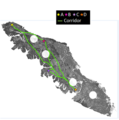
 Coriddor&Path.png 485 × 388; 45 KB
 Rdrain2.png 217 × 219; 2 KB
 FINALOUTPUTMAP.png 462 × 377; 50 KB
 Boundarypoints.png 429 × 359; 36 KB
 RasterCostRaster.png 650 × 883; 162 KB
 Picture1001.png 650 × 884; 162 KB
 Capture1001.png 687 × 457; 139 KB
 Picture1002.png 2,057 × 1,302; 680 KB
 Picture1003.png 1,703 × 927; 420 KB
 Picture1004.png 1,290 × 668; 253 KB
 Presentation1.jpg 720 × 960; 20 KB
 AllPaths MastCostRast.PNG 865 × 704; 260 KB
 AllPaths MastCostRast2.PNG 543 × 451; 119 KB
 AllPaths MastCostRast3.PNG 374 × 377; 68 KB
 Northsea.png 1,379 × 827; 597 KB
 Animated bananashooter.gif 307 × 224; 1.43 MB
 Directory download paint.jpg 472 × 738; 118 KB
 Originaldatamap.JPG 652 × 603; 79 KB
 AddRaster.jpg 40 × 38; 8 KB
 TOC.jpg 258 × 107; 20 KB
 Greywolf.jpg 620 × 349; 123 KB
 Merge DEM.jpg 279 × 407; 55 KB
 Setrisesun.gif 500 × 248; 466 KB
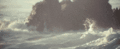 Waves.gif 500 × 206; 499 KB
 AddColumn.png 34 × 31; 1 KB
 FC.png 33 × 31; 969 bytes
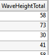 WHfield2.png 100 × 111; 2 KB
 QuickStartOSGeo4w.png 597 × 327; 26 KB
 File-report.png 325 × 201; 5 KB
 BIWEEKLY.png 960 × 540; 332 KB
 OCT1&2.PNG 960 × 540; 315 KB
 OCT3&4.PNG 960 × 540; 317 KB
 NOV1&2.PNG 960 × 540; 319 KB
 NOV3&4.PNG 960 × 540; 313 KB
 OCT2012.PNG 960 × 540; 348 KB
 NOV2012.PNG 960 × 540; 346 KB
 OCT3&44.PNG 960 × 540; 331 KB
 TXT.png 960 × 540; 337 KB
 TM.png 960 × 540; 219 KB
 TM2.jpg 960 × 540; 69 KB
 Report.png 326 × 201; 7 KB
 Report1.png 326 × 201; 7 KB
 Ottawa.png 385 × 472; 51 KB
 Program.png 770 × 607; 56 KB
 DL.png 494 × 328; 36 KB
 Quant Interface.png 1,050 × 749; 82 KB
 StartMenu Quant.png 410 × 477; 26 KB
 Quant Vector.png 959 × 749; 100 KB
 Quant Toolbar.png 568 × 65; 16 KB
 Quant OKVector.png 493 × 241; 24 KB
 Quant BrowzeVector.png 741 × 464; 89 KB
 Quant AddVector.png 493 × 241; 22 KB
 Quant Vector Layers Drawn.png 1,095 × 894; 219 KB
 Quant Vector SelectProperties.png 264 × 448; 18 KB
 Quant Vector Properties.png 793 × 710; 73 KB
 Quant Vector Properties XY.png 793 × 710; 72 KB
 Quant Vector Properties Table.png 779 × 608; 92 KB
 Quantum Project properties.png 694 × 728; 59 KB
 Icon1.png 31 × 31; 2 KB
 Rast1.png 32 × 32; 2 KB
 Quant AddRaster.png 741 × 464; 127 KB
 Quant AddRaster2.png 260 × 520; 26 KB
 Quant Raster Properties.png 771 × 705; 70 KB
 Quant Raster Tranformations.png 454 × 516; 67 KB
 Quant Raster Plugins.png 408 × 115; 22 KB
 Quant Raster Plugins Georef.png 604 × 444; 55 KB
 Quant Raster Plugins Georef2.png 294 × 145; 12 KB
 Quant Raster Georef.png 790 × 652; 52 KB
 Quant Raster Georef image.png 790 × 652; 352 KB
 Quant Raster georef layer.png 1,680 × 1,010; 1.2 MB
 Quant Raster Georef toolbar.png 669 × 65; 17 KB
 Quant Raster Georef points.png 453 × 194; 30 KB
 Addpnt1.png 24 × 24; 970 bytes
 Quant Raster Georef pointstable.png 751 × 932; 574 KB
 SAVERAST.png 63 × 63; 4 KB
 SRS.png 63 × 59; 4 KB
 Pdfrep.png 71 × 61; 4 KB
 Quant Raster Georef xy.png 621 × 537; 50 KB
 Carleton georef1.pdf ; 986 KB
 Quantum Scale.png 567 × 415; 40 KB
 Northscale.png 292 × 151; 13 KB
 Quantum Scale properties.png 358 × 293; 32 KB
 Quantum north.png 567 × 415; 79 KB
 SAGA Logo.PNG 523 × 105; 46 KB
 SAGAIcon.PNG 57 × 78; 8 KB
 SAGAFile.PNG 166 × 40; 8 KB
 GUI.PNG 1,679 × 1,009; 156 KB
 Buffer2.png 336 × 344; 56 KB
 Cont5.png 448 × 216; 82 KB


