Uploads by Pgoszt
From CUOSGwiki
Jump to navigationJump to searchThis special page shows all uploaded files.
| Date | Name | Thumbnail | Size | Description | Versions |
|---|---|---|---|---|---|
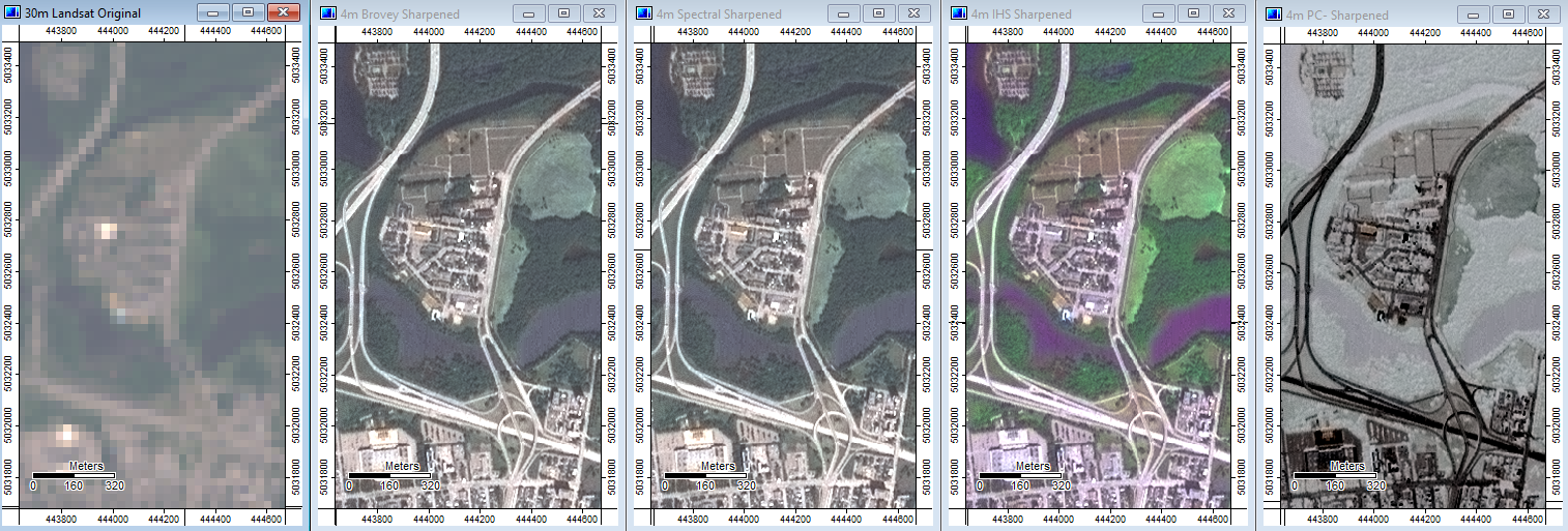
| 02:11, 21 December 2018 | 7 All Methods Comparison.png (file) |  |
1 MB | 1 | |
| 02:10, 21 December 2018 | 6 Spectral PC ToolInputs.png (file) |  |
81 KB | 1 | |
| 02:10, 21 December 2018 | 5 Brovey IHS ToolInputs.png (file) |  |
57 KB | 1 | |
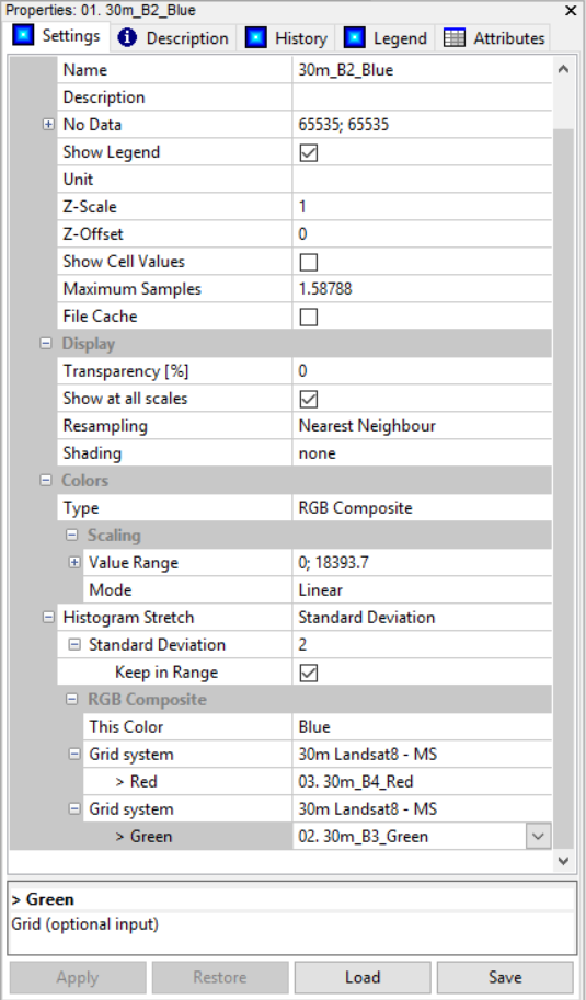
| 02:02, 21 December 2018 | 4 Landsat8MS RGBcomposite.png (file) |  |
109 KB | 1 | |
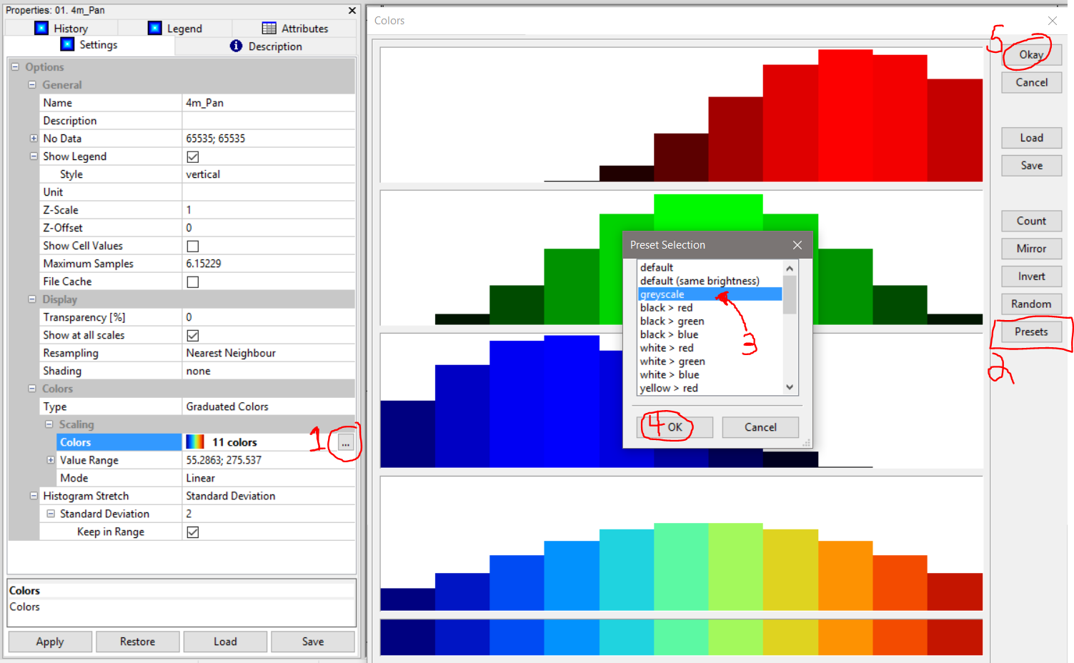
| 02:00, 21 December 2018 | 3 Orbview ChangeToGreyscale.png (file) |  |
173 KB | 1 | |
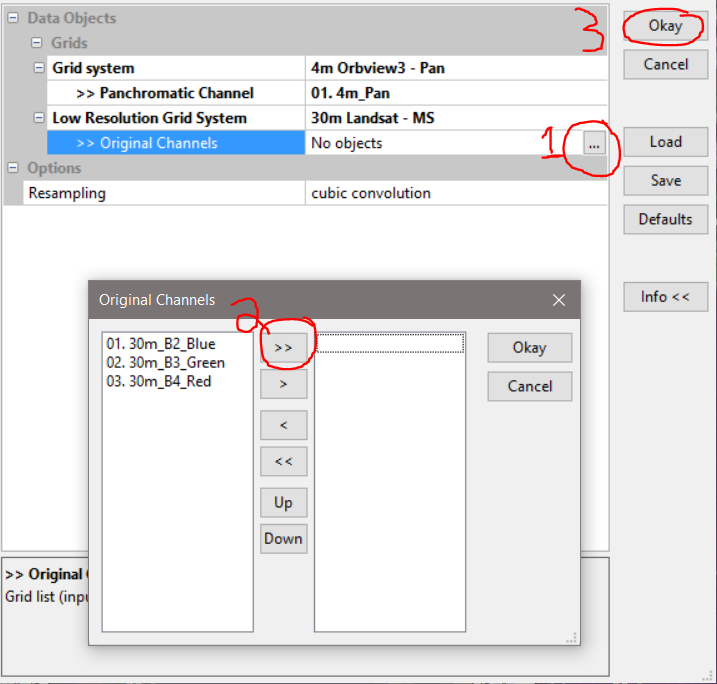
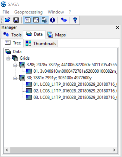
| 01:59, 21 December 2018 | 2 DataPanel NamedGrids.png (file) |  |
47 KB | 1 | |
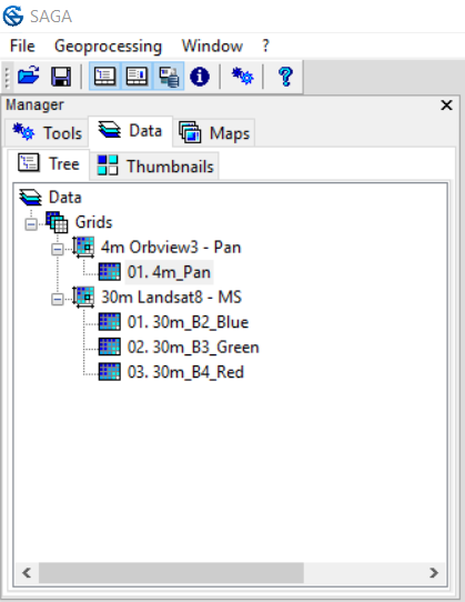
| 01:57, 21 December 2018 | 1 DataPanel UnnamedGrids.png (file) |  |
64 KB | 1 | |
| 22:55, 8 October 2018 | Slope map reclassed.PNG (file) |  |
658 KB | 1 | |
| 19:47, 4 October 2018 | Final map with least cost line.PNG (file) |  |
452 KB | 3 | |
| 19:39, 4 October 2018 | Accumulated cost with points.PNG (file) |  |
351 KB | 2 | |
| 19:25, 4 October 2018 | Slope reclassed values.PNG (file) |  |
45 KB | 1 | |
| 19:24, 4 October 2018 | Reclass tool.PNG (file) |  |
213 KB | 1 | |
| 21:06, 3 October 2018 | Slope annot.PNG (file) |  |
284 KB | 1 | |
| 20:58, 3 October 2018 | Map with point shapes.PNG (file) |  |
46 KB | 1 | |
| 20:56, 3 October 2018 | Map start end points.PNG (file) |  |
414 KB | 1 | |
| 20:53, 3 October 2018 | Maps start end points.PNG (file) |  |
414 KB | 1 | |
| 20:48, 3 October 2018 | Named grid and system annot.PNG (file) |  |
57 KB | 1 | |
| 20:36, 3 October 2018 | Rename dtm grid and system anott.PNG (file) |  |
75 KB | 1 | |
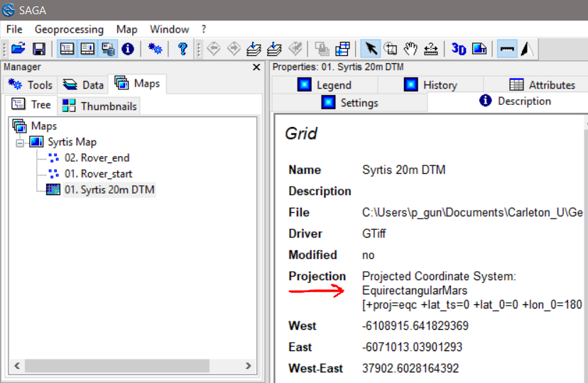
| 18:20, 3 October 2018 | Projection annoted.PNG (file) |  |
114 KB | 1 | |
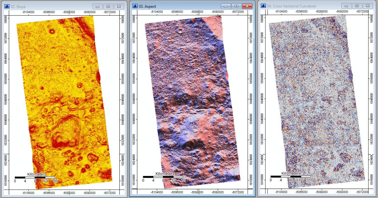
| 18:14, 3 October 2018 | Slope aspect curve output side by side.PNG (file) |  |
1.79 MB | 1 | |
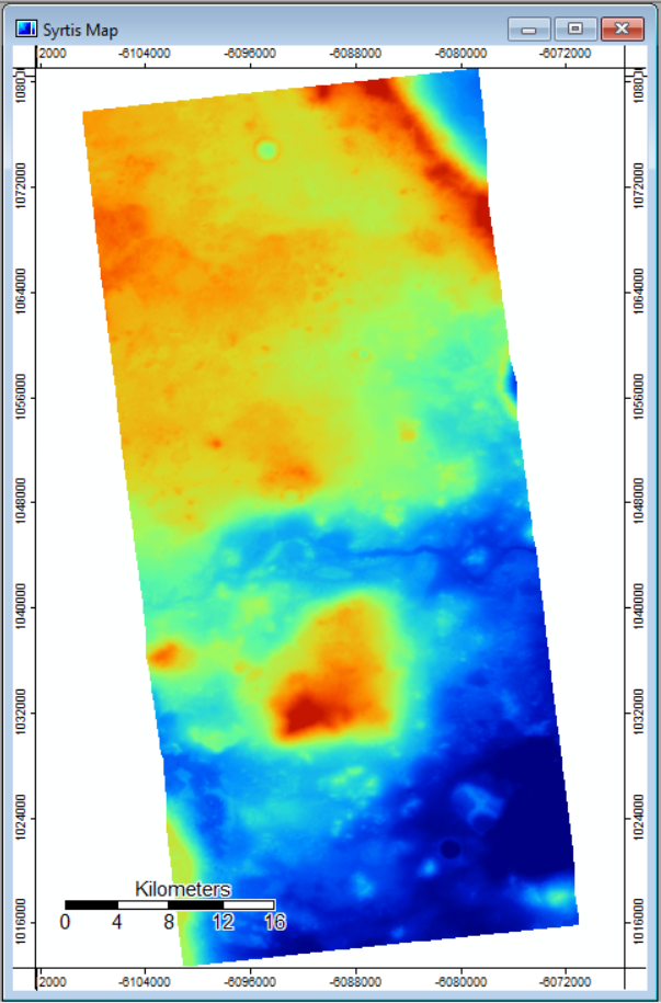
| 18:12, 3 October 2018 | Map with DTM imported.PNG (file) |  |
456 KB | 2 | |
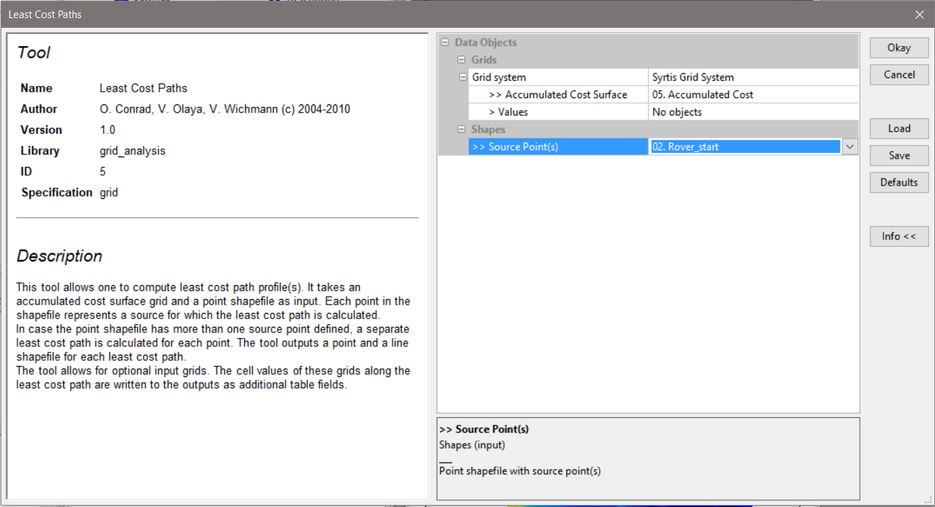
| 18:05, 3 October 2018 | Least cost path tool options.PNG (file) |  |
154 KB | 1 | |
| 18:05, 3 October 2018 | Finished creating shapes.PNG (file) |  |
52 KB | 1 | |
| 18:05, 3 October 2018 | Create point layer Rover start.PNG (file) |  |
135 KB | 1 | |
| 18:02, 3 October 2018 | Add points action tool.PNG (file) |  |
113 KB | 1 |