File:Mapofnewfacilitiesward19.png
From CUOSGwiki
Revision as of 23:37, 20 December 2025 by Harithharison (talk | contribs)
Size of this preview: 800 × 567 pixels. Other resolutions: 320 × 227 pixels | 863 × 612 pixels.
Original file (863 × 612 pixels, file size: 678 KB, MIME type: image/png)
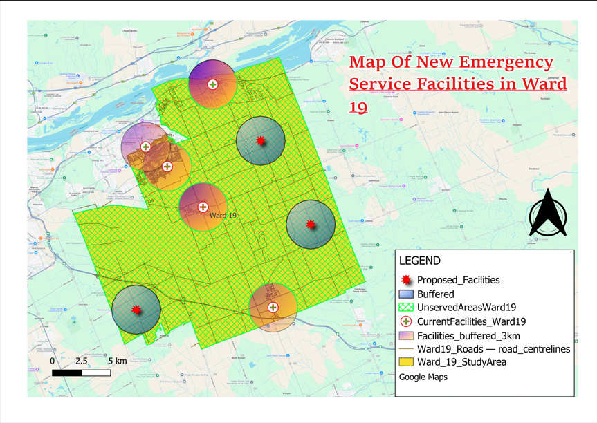
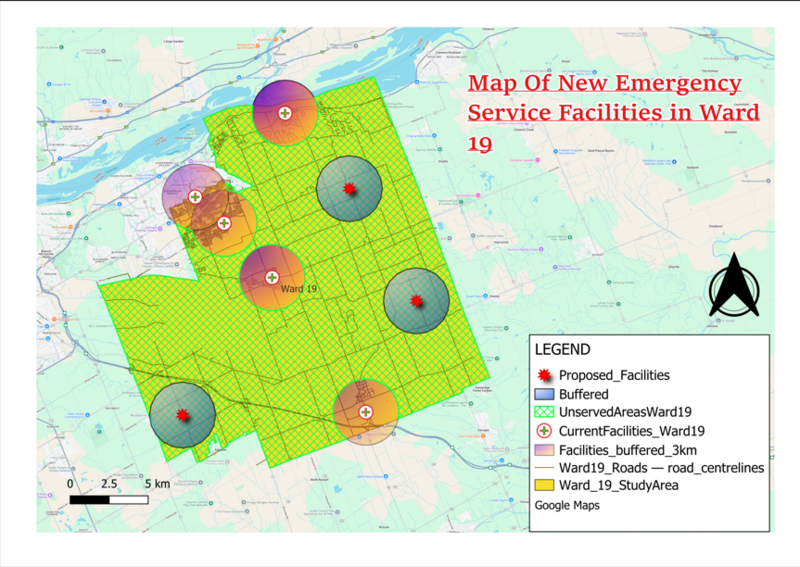
This is a new map of new emergency facilities.
File history
Click on a date/time to view the file as it appeared at that time.
| Date/Time | Thumbnail | Dimensions | User | Comment | |
|---|---|---|---|---|---|
| current | 23:37, 20 December 2025 | | 863 × 612 (678 KB) | Harithharison (talk | contribs) |
You cannot overwrite this file.
File usage
The following page uses this file: