Difference between revisions of "Demonstrating tools in SAGA GIS to analyze Burned areas from Forest Fires"
From CUOSGwiki
Jump to navigationJump to search| Line 8: | Line 8: | ||
==Downloading Imagery from USGS== |
==Downloading Imagery from USGS== |
||
| + | |||
| ⚫ | |||
| ⚫ | |||
| + | |||
[[File:USGS date range.png|300px]] |
[[File:USGS date range.png|300px]] |
||
| + | |||
| ⚫ | |||
| ⚫ | |||
| + | |||
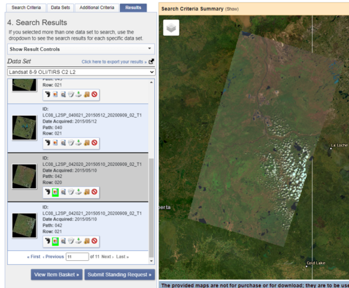
[[File:USGS Imagery selection after fire.png|500px]] |
[[File:USGS Imagery selection after fire.png|500px]] |
||
| + | |||
[[File:USGS Imagery selection before fire.png|500px]] |
[[File:USGS Imagery selection before fire.png|500px]] |
||
| + | |||
| ⚫ | |||
| ⚫ | |||
| + | |||
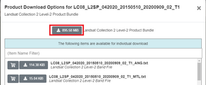
[[File:USGS download files.png|300px]] |
[[File:USGS download files.png|300px]] |
||
Revision as of 17:29, 5 December 2022
Introduction
In recent years forest fires have increased globally at a rapid rate destroying many hectares of vegetation, ecosystems and landscapes (Parajuli, 2019). Being able to analyse forest fires in multiple open source applications like SAGA GIS will benefit anyone looking to study the results of forest fires.
Downloading Saga
This tutorial uses the newest version of SAGA GIS, Version 8.4.1 64bit which can be downloaded here: https://sourceforge.net/projects/saga-gis/files/latest/download
