Introduction to Vegetation Burn Mapping using Open Data Cube
Contents
Introduction to Open Data Cube
In this tutorial the main software framework used is called Open Data Cube (ODC), and who’s primary function is to make geospatial data management and performing analysis with large amounts of satellite data easier. It offers a complete system for ingesting, managing, and analyzing a wide variety of gridded data through a combination of many python libraries and a PostgreSQL database. It is extremely flexible in that it offers several cloud and local deployment options, can work with multispectral imagery to elevation models and interpolated surfaces and a multitude of ways to interface with the software. This tutorial will be using Jupyter Notebooks to work with ODC, but a web GUI is also available. A great way to think about ODC is like your own personal, open-source Google Earth Engine. However, unlike Google Earth Engine you are in control over the geospatial data and code you create. If you would like to learn more about the ODC framework you can check out the official website here.
Installation Instructions
PASTE HERE
Importing Data and Helper Scripts
PASTE HERE
Performing Vegetation Burn Mapping
PASTE HERE
Potential Errors
- If you receive an error during package installation like “Hash Sum Mismatch” then make sure you are using the latest version of Oracle VirtualBox. Version 6.1.16 fixes this bug.
- Ambiguous docker errors including “Cannot Connect to daemon” can be resolved by inserting “sudo” infront of the command you are trying to run.
- If you encounter the following error in figure nine when running scripts in Jupyter Notebooks then you must confirm the entire installation process has been followed.
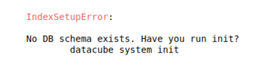
Figure 9. Database Initialization Error.

Sources and Additional Resources
PASTE HERE